IMAGES TAKEN NEAR TO
Bourton, WESTON-SUPER-MARE, BS22 7YA
Introduction
This page details the photographs taken nearby to BS22 7YA by members of the Geograph project.
The Geograph project started in 2005 with the aim of publishing, organising and preserving representative images for every square kilometre of Great Britain, Ireland and the Isle of Man.

There are currently over 7.5m images from over14,400 individuals and you can help contribute to the project by visiting https://www.geograph.org.uk
Image Map
Images are licensed for reuse under creativecommons.org/licenses/by-sa/2.0
Notes
- Clicking on the map will re-center to the selected point.
- The higher the marker number, the further away the image location is from the centre of the postcode.
Image Listing (6 Images Found)
Images are licensed for reuse under creativecommons.org/licenses/by-sa/2.0
Image
Details
Distance
4
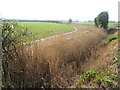
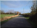
A drainage ditch near Bourton
Leaving the sprawl of the Ebdon housing area behind, the remaining flat farmland is criss-crossed with lots of drainage ditches. Here a little stand of reeds have taken hold.
Image: © Neil Owen
Taken: 4 Apr 2021
0.16 miles
5
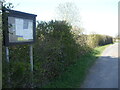
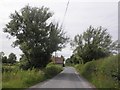
The latest news on Ebdon Lane
The hamlet of Bourton is barely more than a handful of farms but the local noticeboard has nevertheless been erected here at the road junction.
Image: © Neil Owen
Taken: 4 Apr 2021
0.21 miles