IMAGES TAKEN NEAR TO
Braikenridge Close, CLEVEDON, BS21 5LA
Introduction
This page details the photographs taken nearby to Braikenridge Close, BS21 5LA by members of the Geograph project.
The Geograph project started in 2005 with the aim of publishing, organising and preserving representative images for every square kilometre of Great Britain, Ireland and the Isle of Man.

There are currently over 7.5m images from over14,400 individuals and you can help contribute to the project by visiting https://www.geograph.org.uk
Image Map (Loading...)


Getting Data...Please wait
Leaflet Map data © OpenStreetMap
Images are licensed for reuse under creativecommons.org/licenses/by-sa/2.0
Notes
- Clicking on the map will re-center to the selected point.
- The higher the marker number, the further away the image location is from the centre of the postcode.
Image Listing (22 Images Found)
Images are licensed for reuse under creativecommons.org/licenses/by-sa/2.0
Image
Details
Distance
1
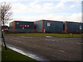
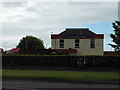
Strode Road, Industrial units
Situated off Southern Way.
Image: © Anthony Vosper
Taken: 16 Feb 2010
0.08 miles
2
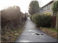
River Walk
A small service footpath running parallel to both the trackway and the Blind yeo.
Image: © Anthony Vosper
Taken: 16 Feb 2010
0.17 miles
3
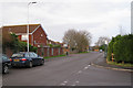
Strode Road at its junction with Mill Cross, Clevedon
Image: © Robin Stott
Taken: 9 Dec 2009
0.17 miles
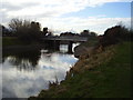
4
Strode Road bridge
The Blind Yeo near Clevedon.
Image: © Neil Owen
Taken: 27 Sep 2020
0.18 miles
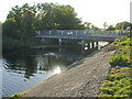
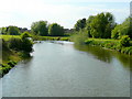
6
Strode Road crosses the Blind Yeo
The slow moving river reflects the late afternoon sky.
Image: © Anthony Vosper
Taken: 16 Feb 2010
0.19 miles
7
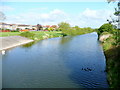
Blind Yeo 1
Looking east, upstream, from the Lower Strode Road Bridge south of Clevedon.
Image: © Jonathan Billinger
Taken: 28 Apr 2009
0.20 miles
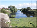
9
Blind Yeo 2
Looking west, downstream, from the Lower Strode Road Bridge south of Clevedon.
Image: © Jonathan Billinger
Taken: 28 Apr 2009
0.21 miles