1
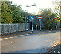
Entrance to St Martin's Court, Bristol
If the board at the Cole Street entrance to St Martin's Court was accurate, only one of the six industrial units was occupied at the early November 2012 date of this view.
Image: © Jaggery
Taken: 8 Nov 2012
0.02 miles
2
Cole Road, Bristol
Viewed from Feeder Road looking towards the Cole Road premises of H J Chard & Sons, builders merchants.
Image: © Jaggery
Taken: 8 Nov 2012
0.02 miles
3
A4320 flyover
Image: © N Chadwick
Taken: 10 Jan 2016
0.04 miles
4
Short cut from Cole Road to Avon Meads Retail Park, Bristol
The left turn under the railway is a No Entry road for motor vehicles, but is a route available to walkers and cyclists.
Image: © Jaggery
Taken: 8 Nov 2012
0.05 miles
5
Road and rail bridges crossing the Bristol Harbour feeder canal, entering Bristol.
This is the feeder canal leading from the river Avon into Bristol Floating Harbour.
Image: © Martyn Pattison
Taken: 2 Aug 2005
0.05 miles
6
Under North Somerset railway junction, Bristol
A path and cycle route under railway lines in part of North Somerset junction give a short cut to Avon Meads Retail Park.
Image: © Jaggery
Taken: 8 Nov 2012
0.06 miles
7
A4320 flyover
Image: © N Chadwick
Taken: 5 Aug 2018
0.06 miles
8
Railway bridge over Feeder Road
There is an OS benchmark
Image at the base of the bridge wall close to its near end
Image: © Roger Templeman
Taken: 2 May 2017
0.06 miles
9
Metal barrier across former road to Cole Road, Bristol
This route, which passes under part of the North Somerset railway junction ahead, is now a path and cycle route. Disused traffic lights next to a triangular sign in the background are a relic of its former use as a road.
Image: © Jaggery
Taken: 8 Nov 2012
0.07 miles
10
Four bridges over The Feeder, Bristol
Viewed along Feeder Road. There are two main bridges. The lighter-coloured bridge (between the two grey ones) carries the A4320 St Philips Causeway. Furthest away, visible in the distance on the right, is a railway bridge. The bridges cross The Feeder which connects the city centre Floating Harbour (near Temple Meads Station) with the River Avon upstream of Netham Weir.
Image: © Jaggery
Taken: 8 Nov 2012
0.07 miles


