IMAGES TAKEN NEAR TO
Ridge Close, BRISTOL, BS20 8RQ
Introduction
This page details the photographs taken nearby to Ridge Close, BS20 8RQ by members of the Geograph project.
The Geograph project started in 2005 with the aim of publishing, organising and preserving representative images for every square kilometre of Great Britain, Ireland and the Isle of Man.

There are currently over 7.5m images from over14,400 individuals and you can help contribute to the project by visiting https://www.geograph.org.uk
Image Map
Images are licensed for reuse under creativecommons.org/licenses/by-sa/2.0
Notes
- Clicking on the map will re-center to the selected point.
- The higher the marker number, the further away the image location is from the centre of the postcode.
Image Listing (31 Images Found)
Images are licensed for reuse under creativecommons.org/licenses/by-sa/2.0
Image
Details
Distance
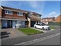
1
High View
Hilltop housing estate in Portishead.
Image: © Richard Webb
Taken: 18 Apr 2011
0.04 miles
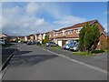
4
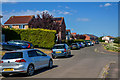
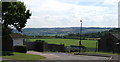
Portishead : Houses
Houses seen from Portishead Down.
Image: © Lewis Clarke
Taken: 2 Jun 2020
0.10 miles
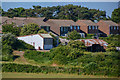
6
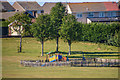
Portishead : Merlin Park Playground
Looking to a play area in Merlin Park.
Image: © Lewis Clarke
Taken: 2 Jun 2020
0.13 miles
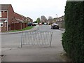
7
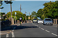
Portishead : Down Road
Looking along Down Road.
Image: © Lewis Clarke
Taken: 2 Jun 2020
0.13 miles
8
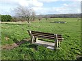
Portishead : Merlin Park
Looking along Merlin Park.
Image: © Lewis Clarke
Taken: 2 Jun 2020
0.14 miles
10
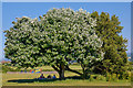
Portishead : Merlin Park
Looking towards people enjoying the shade under the tree.
Image: © Lewis Clarke
Taken: 2 Jun 2020
0.14 miles