IMAGES TAKEN NEAR TO
Redcliff Street, BRISTOL, BS1 6WN
Introduction
This page details the photographs taken nearby to Redcliff Street, BS1 6WN by members of the Geograph project.
The Geograph project started in 2005 with the aim of publishing, organising and preserving representative images for every square kilometre of Great Britain, Ireland and the Isle of Man.

There are currently over 7.5m images from over14,400 individuals and you can help contribute to the project by visiting https://www.geograph.org.uk
Image Map
Images are licensed for reuse under creativecommons.org/licenses/by-sa/2.0
Notes
- Clicking on the map will re-center to the selected point.
- The higher the marker number, the further away the image location is from the centre of the postcode.
Image Listing (1690 Images Found)
Images are licensed for reuse under creativecommons.org/licenses/by-sa/2.0
Image
Details
Distance
1
Going back in time
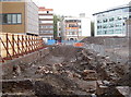
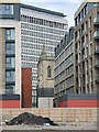
The new redevelopment of the Redcliffe Street/Thomas Street area has revealed some interesting remains. Redcliffe is now very much part of the old city of Bristol. but was for centuries a separate settlement on the south side of the River Avon. Slowly, the influence and industries spread and took hold here until the inevitable amalgamation. What lies here are many building foundations, waste pits and associated structures that can be dated back to the twelfth century - all part of the story of Redcliffe.
Image: © Neil Owen
Taken: 11 May 2016
0.00 miles
2
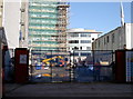
The past being rebuilt
As part of the ever-ongoing redevelopment of Redcliffe, the demolition of old warehouses and offices often reveal older foundations - some dating back centuries. Archaeologists move in to explore for a while until the workers arrive to start the reinterring. Compare this shot with Image
Image: © Neil Owen
Taken: 13 Mar 2018
0.01 miles
3
Learning about the distant past
A passer-by stops in Redcliffe Street; the once-familiar warehouses and offices are largely cleared now, allowing a glimpse at the earlier ground level. Having removed the topsoil too, construction was stopped to allow archaeologists time to delve deeper into the foundations. Most of this part of Bristol, close to Bristol Bridge, is post-war redevelopment that is now itself being redeveloped. But going into the ground has brought older foundations to light - some going back centuries. See Image
Image: © Neil Owen
Taken: 11 May 2016
0.01 miles
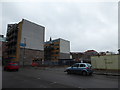
4
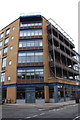
New building at Redcliff Street / Thomas Lane junction
Image: © Roger Templeman
Taken: 4 Feb 2018
0.01 miles
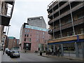
5
Temple Meads to Ashton Gate (18)
Mid section of Redcliff Street
Image: © Basher Eyre
Taken: 13 Feb 2016
0.02 miles
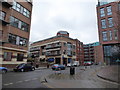
6
Temple Meads to Ashton Gate (19)
Approaching the Bristol Civil Justice Centre
Image: © Basher Eyre
Taken: 13 Feb 2016
0.03 miles
7
Temple Meads to Ashton Gate (20)
Redcliff Quay
Image: © Basher Eyre
Taken: 13 Feb 2016
0.03 miles
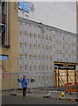
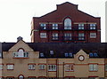
8
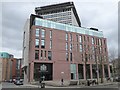
Bristol Civil Justice Centre
New building on Redcliff Street.
Image: © Oliver Dixon
Taken: 10 Mar 2017
0.03 miles
9
St Thomas overshadowed
St Thomas the Martyr was founded in the fourteenth century, with many new additions in the 1790s - long before the twentieth century crowded in. Soon the twenty-first century will be moving in too when the cleared site is developed.
See Image] to get a better perspective on the redevelopment site.
Image: © Neil Owen
Taken: 23 Jul 2021
0.03 miles
10
Iteration of the past
Some of the new buildings have been selectively styled to blend in with the old wharf warehouses of the past. Both are now residential.
Image: © Neil Owen
Taken: 13 Mar 2018
0.03 miles