1
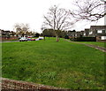
Grass, trees and houses, Pucklechurch
Oaktree Avenue is on the left.
Image: © Jaggery
Taken: 5 Feb 2016
0.10 miles
2
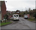
Oaktree Avenue, Pucklechurch
Viewed across Abson Road.
Image: © Jaggery
Taken: 5 Feb 2016
0.10 miles
3
Southeast side of a pedestrian underpass, Pucklechurch
Under Oaktree Avenue.
Image: © Jaggery
Taken: 5 Feb 2016
0.11 miles
4
Holly Close, Pucklechurch
On the southeast side of Oaktree Avenue.
Image: © Jaggery
Taken: 5 Feb 2016
0.11 miles
5
Northwest side of a pedestrian underpass, Pucklechurch
Under Oaktree Avenue.
Image: © Jaggery
Taken: 5 Feb 2016
0.11 miles
6
Oaktree Avenue electricity substation, Pucklechurch
The dark green cabinet on the corner of Oaktree Avenue and Holly Close is a Western Power Distribution (South West) electricity substation. Its identifier is 2305 OAKTREE AVE P S/S.
Image: © Jaggery
Taken: 5 Feb 2016
0.12 miles
7
Footpath sign, Pucklechurch
Facing this underpass http://www.geograph.org.uk/photo/4816989, the white on black sign is on a lamppost. Behind the lamppost, a name sign shows CEDAR WAY.
Image: © Jaggery
Taken: 5 Feb 2016
0.12 miles
8
Oaktree Avenue lockup garages, Pucklechurch
Between Oaktree Avenue and Holly Close.
Image: © Jaggery
Taken: 5 Feb 2016
0.13 miles
9
Barrage balloon mooring site
The semi-circle of more scrubby looking grass is the location of a World War Two barrage balloon mooring site in Pucklechurch. There are various small concrete pads set into this area of ground, some with metal rings attached, and also the outline of a small building. The exposed concrete in the foreground is the most obvious feature that would be evident to a casual observer visiting this site.
Image: © Ruth Riddle
Taken: 29 Jan 2011
0.15 miles
10
Queen Elizabeth II pillarbox, Oaktree Avenue, Pucklechurch
Located here. http://www.geograph.org.uk/photo/4816676
Image: © Jaggery
Taken: 5 Feb 2016
0.15 miles


