1
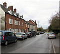
Parkfield Road Pucklechurch
Viewed from the grass triangle at the Westerleigh Road junction.
Image: © Jaggery
Taken: 5 Feb 2016
0.09 miles
2
Parkfield Road houses and cars, Pucklechurch
Viewed from near the Westerleigh Road junction.
Image: © Jaggery
Taken: 5 Feb 2016
0.12 miles
3
B4465 distances and directions signs on a grass triangle, Pucklechurch
At the Parkfield Road junction, turn left on the B4465 Westerleigh Road for Siston and Hinton, or right for Westerleigh and Yate.
Image: © Jaggery
Taken: 5 Feb 2016
0.16 miles
4
Warning sign - low bridge 1 mile ahead, Parkfield Road, Pucklechurch
The sign is at the edge of a grass triangle one mile from a bridge with 11' 9" headroom.
Image: © Jaggery
Taken: 5 Feb 2016
0.16 miles
5
Life saving emergency equipment, Pucklechurch
Located here, http://www.geograph.org.uk/photo/5108550 the green box contains a defibrillator.
Instructions on its use are alongside it.
Image: © Jaggery
Taken: 5 Feb 2016
0.16 miles
6
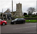
The Old Dairy @ The Coach House, Pucklechurch
Cafe viewed across Westerleigh Road in February 2016.
A March 2009 Google Earth Street View shows Ye Olde Coach House here.
The green box http://www.geograph.org.uk/photo/5108555 on the wall contains a defibrillator.
Image: © Jaggery
Taken: 5 Feb 2016
0.16 miles
7
Grade II listed Pucklechurch House, Pucklechurch
The house on the west side of Westerleigh Road dates from the late 18th century with later extensions and alterations. Grade II listed in 1985.
Image: © Jaggery
Taken: 5 Feb 2016
0.17 miles
8
Hero's in Pucklechurch
Hero's hair salon is at 12 Westerleigh Road. The 20 is on a banner showing
CELEBRATING 20 YEARS 1ST JULY 2013.
The tower of the Parish Church of Saint Thomas a Becket is on the right.
Image: © Jaggery
Taken: 5 Feb 2016
0.18 miles
9
Warning sign - school, Westerleigh Road, Pucklechurch
On the approach to the village primary school.
Image: © Jaggery
Taken: 5 Feb 2016
0.18 miles
10
Russett House, Westerleigh Road, Pucklechurch
The black nameplate on the left shows RUSSETT HOUSE.
Image: © Jaggery
Taken: 5 Feb 2016
0.18 miles


