
IMAGES TAKEN NEAR TO
Colston Hill, BRISTOL, BS16 1AR
Introduction
This page details the photographs taken nearby to Colston Hill, BS16 1AR by members of the Geograph project.
The Geograph project started in 2005 with the aim of publishing, organising and preserving representative images for every square kilometre of Great Britain, Ireland and the Isle of Man.

There are currently over 7.5m images from over14,400 individuals and you can help contribute to the project by visiting https://www.geograph.org.uk
Image Map
Images are licensed for reuse under creativecommons.org/licenses/by-sa/2.0
Notes
- Clicking on the map will re-center to the selected point.
- The higher the marker number, the further away the image location is from the centre of the postcode.
Image Listing (57 Images Found)
Images are licensed for reuse under creativecommons.org/licenses/by-sa/2.0
Image
Details
Distance
1
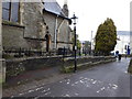
Gas-light near Holy Trinity Church
Gas lamp at the rear of Holy Trinity Church - this is a working lamp, but is not the original, worked by a light sensor. Image
Image: © Eirian Evans
Taken: 19 Feb 2018
0.02 miles
2
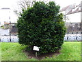
Millennium Yew, Stapleton Church
This tree is taken from a cutting of the Ulsombe Yew, Kent, which is over 2000 years old.
Image: © Eirian Evans
Taken: 19 Feb 2018
0.03 miles
3
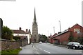
Holy Trinity Church, Stapleton
Built in 1857 by John Norton, a renowned Bristol builder.
Image: © Eirian Evans
Taken: 19 Feb 2018
0.03 miles
4
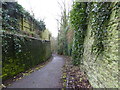
Colston Hill
Leading down to Eastville Park
Image: © Eirian Evans
Taken: 19 Feb 2018
0.04 miles
5
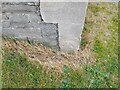
Ordnance Survey Cut Mark
This OS cut mark can be found on the west angle of Holy Trinity Church. It marks a point 38.950m above mean sea level.
Image: © Adrian Dust
Taken: 27 Jul 2022
0.04 miles
6
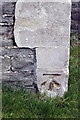
Benchmark on tower buttress of Holy Trinity Stapleton
Ordnance Survey cut mark benchmark described on the Bench Mark Database at http://www.bench-marks.org.uk/bm47953
Image: © Roger Templeman
Taken: 9 Apr 2013
0.04 miles
7
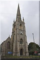
Holy Trinity Stapleton church
There is an OS benchmark Image on the tower buttress to the right of the blue notice, and the spire is an OS intersected station trig point, http://www.trigpointinguk.com/trigs/trig-details.php?t=8748
Image: © Roger Templeman
Taken: 9 Apr 2013
0.04 miles
8
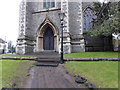
Gaslamp at the front of Holy Trinity Church
Old gas-light holder at the front of the church, there is a second at the rear of the church
Image: © Eirian Evans
Taken: 19 Feb 2018
0.04 miles
9
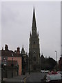
Stapleton Parish Church Bristol
The church is prominently positioned at the top of the hill from the M32 motorway junction
Image: © Peter Watkins
Taken: 17 Mar 2006
0.08 miles
10
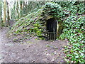
Ice Cave, Eastville Park
An early form of refrigeration, the cave belonged to Stapleton Manor House (now Colston School).
Image: © Eirian Evans
Taken: 19 Feb 2018
0.10 miles