IMAGES TAKEN NEAR TO
Footshill Drive, BRISTOL, BS15 8EY
Introduction
This page details the photographs taken nearby to Footshill Drive, BS15 8EY by members of the Geograph project.
The Geograph project started in 2005 with the aim of publishing, organising and preserving representative images for every square kilometre of Great Britain, Ireland and the Isle of Man.

There are currently over 7.5m images from over14,400 individuals and you can help contribute to the project by visiting https://www.geograph.org.uk
Image Map (Loading...)


Getting Data...Please wait
Leaflet Map data © OpenStreetMap
Images are licensed for reuse under creativecommons.org/licenses/by-sa/2.0
Notes
- Clicking on the map will re-center to the selected point.
- The higher the marker number, the further away the image location is from the centre of the postcode.
Image Listing (5 Images Found)
Images are licensed for reuse under creativecommons.org/licenses/by-sa/2.0
Image
Details
Distance
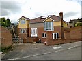
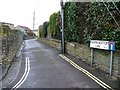
2
Sheldare Barton
Not a 1930s movie star! An infill cul-de-sac off Furber Road.
Image: © Christine Johnstone
Taken: 23 Mar 2013
0.21 miles
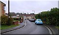
4
Public footpath to Footshill Road
Running north from Tabernacle Road.
Image: © Christine Johnstone
Taken: 23 Mar 2013
0.25 miles
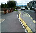
5
Magpie Bottom Lane, BS5
Connecting Furber Road and the valley called Magpie Bottom.
Image: © Christine Johnstone
Taken: 23 Mar 2013
0.25 miles