1
Bathurst Basin
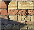
Note the intricate designs in the brickwork on the building on Bathurst Parade.
Image: © Thomas Nugent
Taken: 28 Sep 2010
0.01 miles
2
Bathurst Basin
Bathurst Parade is on the left.
Image: © Thomas Nugent
Taken: 28 Sep 2010
0.02 miles
3
Bathurst Basin and Bathurst Parade
The channel leads to the Avon New Cut which is behind the photographer, across Commercial Road.
Image: © Thomas Nugent
Taken: 28 Sep 2010
0.02 miles
4
Narrowboats at Bathurst Basin
On the Bathurst Parade side of the basin.
Image: © Thomas Nugent
Taken: 28 Sep 2010
0.02 miles
5
Byzantine Court, Bathurst Parade
This building, a notable example of the "Bristol Byzantine" style, was put up in 1874 as warehouse (left) and office for the Robinson oil seed company. In 1980 the building was demolished but its façade was cleaned and left standing as a frontage for flats and squash courts.
Image: © Eirian Evans
Taken: 23 Jun 2014
0.02 miles
6
Damaged Brickwork
This damaged brickwork can be found on the SE face of the building on Bathurst Parade.
Image: © Adrian Dust
Taken: 19 Jan 2020
0.02 miles
7
Robinson's Warehouse, Bathurst Basin, Bristol
Warehouse and office, built 1875 and reconstructed in 1981. Facade by W B Gingell in Venetian Gothic style with red and yellow brick. Originally part of John Robinson's oil seed mill. The mill was demolished but the facades retained. Listed Grade II.
Image: © Chris Allen
Taken: 16 Jul 2022
0.02 miles
8
Ordnance Survey Cut Mark
This OS cut mark can be found on the NW side of Bathurst Parade. It marks a point 9.303m above mean sea level.
Image: © Adrian Dust
Taken: 13 Mar 2020
0.02 miles
9
Byzantine Court
The Bathurst Basin was a small offshoot of the Floating Harbour, where mills and warehouses jostled for trade coming up the river. Here are what were once offices and warehousing for a number of firms in the past, but which are now converted into residential use.
The 'Bristol Byzantine' style used varied colour brickwork to create the appearance seen here, and other buildings nearby. The arhcitect was William Bruce Gingell and produced the buildings for John Robinson's Oil Seed Mill. In later times they were known as Warriner's warehouses before the 1980s brought much demolition; the facade was retained but was no longer a commercial site.
Grade II listed.
Image: © Neil Owen
Taken: 14 Mar 2022
0.02 miles
10
Bathurst Lock Swing Bridge
Pedestrian bridge across the entrance to the Bathurst Basin.
Image: © Linda Bailey
Taken: 25 Oct 2004
0.02 miles


