1
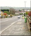
Vacant land, Bishopsworth
Being linear in nature, this look rather like the course of an old railway line, but there was none here. Could it have been intended as a road by planners? On the left is
Image
Image: © Derek Harper
Taken: 16 Nov 2013
0.10 miles
2
Houses on Queen's Road
At the bend is the junction with King George's Road. Just this side of the junction is the pink facade of the Queen's Arms.
Image: © Derek Harper
Taken: 16 Nov 2013
0.11 miles
3
Type 'K' in Queen's Road
A pillar box in front of some elderly residences - the familiar box is a common enough sight. It is a type 'K' and the design dates from 1979, but has naturally been superseded.
Image: © Neil Owen
Taken: 4 Feb 2013
0.12 miles
4
Waverley Gardens, Bishopsworth
"Waverley Gardens is an extra care housing scheme owned and operated by Brunelcare, which provides housing, care and support for older people ... Opened in September 2009, the scheme consists of 66 apartments" http://www.housinglin.org.uk/Topics/ECHScheme/search/Overview/?cid=8305 .
Image: © Derek Harper
Taken: 16 Nov 2013
0.13 miles
5
Queen's Road shops
A rank of small shops and stores, provided in the planning of the Withywood estate built in the post-war period.
Image: © Neil Owen
Taken: 4 Feb 2013
0.14 miles
6
Queen's Road, Bishopsworth
Taken from Grange Road, which from the junction ahead with Queen's Road becomes ... Queen's Road! In the background is Dundry Hill.
Image: © Derek Harper
Taken: 16 Nov 2013
0.15 miles
7
Houses under construction, Withywood
These houses are being built on the site of the Rising Sun pub - see
Image - at the junction of Queen's Road with Three Wells Road (right).
Image: © Derek Harper
Taken: 16 Nov 2013
0.16 miles
8
Don't let the sun go down on me
Queens Road boozer now looking pretty ripe for the bulldozers. Having been closed for a good few years now the rot has started - part of the roof has gone and the locals often hasten the process. See
Image] for a view from the side. No news as to what the future of the Rising Sun has surfaced yet.
Image: © Neil Owen
Taken: 4 Feb 2013
0.17 miles
9
The sun setting on the Rising Sun
A typical scene these days: a pub, boarded up and slowly crumbling, no sign of any salvation. Despite being a fairly modern one the times have proven too hard to sustain, and there's not much joy on the horizon. See
Image] for a frontal view.
Image: © Neil Owen
Taken: 4 Feb 2013
0.17 miles
10
The Withywood Centre
"The centre now provides a church, a health centre, community cafe, function halls, internet cafe, youth cafe, play zone, meeting rooms, advice centre and project offices" http://www.bristolpost.co.uk/Vote-community-buildings-RIBA-awards/story-11296771-detail/story.html .
Image: © Derek Harper
Taken: 16 Nov 2013
0.20 miles


