1
Electricity substation, Southmead Road, Bristol
Located in a fenced-off enclosure near the corner of Delvin Road.
Image: © Jaggery
Taken: 30 Jan 2013
0.07 miles
2
Southmead Road between Francis Road and Evelyn Road, Bristol
Viewed along Southmead Road from opposite the corner of Francis Road.
Image: © Jaggery
Taken: 30 Jan 2013
0.07 miles
3
City Bridge Dental Care, Bristol
Located at 187 Southmead Road, Westbury-on-Trym, Bristol, on the corner of Evelyn Road, City Bridge Dental Care is a private dental practice specialising in cosmetic dentistry and family dentistry.
Image: © Jaggery
Taken: 30 Jan 2013
0.07 miles
4
Distinctive corner house, Westbury-on-Trym, Bristol
The white flat-roofed house on the corner of Southmead Road and Cranham Road is unlike any house nearby.
Image: © Jaggery
Taken: 30 Jan 2013
0.09 miles
5
Southmead allotments, Bristol
The allotments occupy a roughly rectangular area SW of Doncaster Road. The distant houses are in Delvin Road.
Image: © Jaggery
Taken: 30 Jan 2013
0.10 miles
6
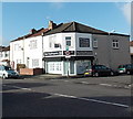
Blue Chip Property, Bristol
Property lettings & management office at 175 Southmead Road,
Westbury-on-Trym, Bristol, on the corner of Cranham Road.
Image: © Jaggery
Taken: 30 Jan 2013
0.10 miles
7
Southmead Road, Eastfield
Image: © David Howard
Taken: 1 Jun 2019
0.12 miles
8
New house, Cranham Road
Image: © Alex McGregor
Taken: 11 Apr 2013
0.12 miles
9
Development, 16 Cranham Road
Image: © Alex McGregor
Taken: 8 Aug 2012
0.13 miles
10
Southmead Fire Station, Bristol
The name board shows
AVON FIRE & RESCUE
SOUTHMEAD COMMUNITY SAFETY CENTRE.
The location is the SE side of Southmead Road, opposite Charis Avenue.
The fire station was built in 1960.
Image: © Jaggery
Taken: 30 Jan 2013
0.13 miles


