
IMAGES TAKEN NEAR TO
Button Street, SWANLEY, BR8 8DY
Introduction
This page details the photographs taken nearby to Button Street, BR8 8DY by members of the Geograph project.
The Geograph project started in 2005 with the aim of publishing, organising and preserving representative images for every square kilometre of Great Britain, Ireland and the Isle of Man.

There are currently over 7.5m images from over14,400 individuals and you can help contribute to the project by visiting https://www.geograph.org.uk
Image Map
Images are licensed for reuse under creativecommons.org/licenses/by-sa/2.0
Notes
- Clicking on the map will re-center to the selected point.
- The higher the marker number, the further away the image location is from the centre of the postcode.
Image Listing (23 Images Found)
Images are licensed for reuse under creativecommons.org/licenses/by-sa/2.0
Image
Details
Distance
1
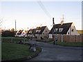
Wadard Terrace
An isolated row of semi-detached houses on Button Street.
Image: © Stephen Craven
Taken: 26 Dec 2013
0.09 miles
2
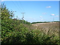
View from Button Street
This view is from Button Street, not far from the M20, and looks across a field behind Wadard Terrace.
Image: © Marathon
Taken: 4 Oct 2012
0.09 miles
3

Pylon adjacent to Button Street
This is a particularly tall electricity pylon as it has to support cables spanning some 350 metres across the M20/M25 junction.
Image: © Stephen Craven
Taken: 26 Dec 2013
0.16 miles
4
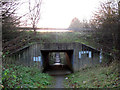
Motorway underpass
The road above is the slip road from the M25 clockwise to the M20 eastbound. The path is a public footpath from Button Street to London Road.
Image: © Stephen Craven
Taken: 26 Dec 2013
0.17 miles
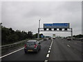


10
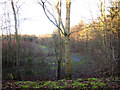
Space between the motorways
The low-lying land shown here, seen from an adjacent footpath, forms roughly a triangle between the M20, M25 and the slip road between them. The map shows a "balancing pond" occupying the site but despite heavy rain in recent days there was no sign of it in this view.
Image: © Stephen Craven
Taken: 26 Dec 2013
0.20 miles