IMAGES TAKEN NEAR TO
Norton Terrace, NEWHAVEN, BN9 0BT
Introduction
This page details the photographs taken nearby to Norton Terrace, BN9 0BT by members of the Geograph project.
The Geograph project started in 2005 with the aim of publishing, organising and preserving representative images for every square kilometre of Great Britain, Ireland and the Isle of Man.

There are currently over 7.5m images from over14,400 individuals and you can help contribute to the project by visiting https://www.geograph.org.uk
Image Map
Images are licensed for reuse under creativecommons.org/licenses/by-sa/2.0
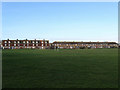
Notes
- Clicking on the map will re-center to the selected point.
- The higher the marker number, the further away the image location is from the centre of the postcode.
Image Listing (136 Images Found)
Images are licensed for reuse under creativecommons.org/licenses/by-sa/2.0
Image
Details
Distance
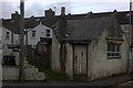
2
Baker Street
Small side street linking Clifton Road to Norton Terrace and the northerly edge of a small area of residential roads in the midst of the factories and workshops that occupy the eastern side of the harbour.
Image: © Simon Carey
Taken: 26 Aug 2012
0.03 miles
3
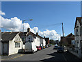
Norton Road
Small side street off Clifton Road that is the main access route for those living on Norton Terrace and Eastbridge Road.
Image: © Simon Carey
Taken: 26 Aug 2012
0.04 miles
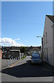
4
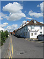
Clifton Road
An area of residential dwellings amidst the factories and workshops on the eastern side of the river.
Image: © Simon Carey
Taken: 26 Aug 2012
0.04 miles
5
Parker Pen Factory, Railway Road
The American company opened its first European manufacturing base on this site in 1924 and has remained here through numerous changes of ownership ever since.
Image: © Simon Carey
Taken: 23 Oct 2007
0.04 miles
6
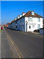
Clifton Road
The road south of the A259 whilst straight changes name 3 times, starting out as Railway Road before changing to Clifton Road then finally to Beach Road. Another terraced row of houses squeezed between factories to the north and south of it. The Engineer pub can just be made out at the end of the row.
Image: © Simon Carey
Taken: 23 Oct 2007
0.04 miles
7
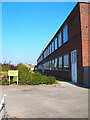
Brightwell Industrial Estate
Located on Norton Road next to Bevan Funnell.
Image: © Simon Carey
Taken: 23 Aug 2012
0.05 miles
8
Eastbridge Road
Viewed from the eastern side of the recreation ground. The east side of the Ouse is mostly industrial and port facilities though some of the older terraced houses for the original dock workers still remain.
Image: © Simon Carey
Taken: 21 Feb 2009
0.05 miles
9
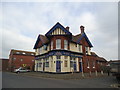
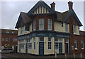
The Engineer public house, Railway Road, Newhaven
Image: © Stacey Harris
Taken: 11 Mar 2012
0.05 miles