IMAGES TAKEN NEAR TO
Drove Road, NEWHAVEN, BN9 0AD
Introduction
This page details the photographs taken nearby to Drove Road, BN9 0AD by members of the Geograph project.
The Geograph project started in 2005 with the aim of publishing, organising and preserving representative images for every square kilometre of Great Britain, Ireland and the Isle of Man.

There are currently over 7.5m images from over14,400 individuals and you can help contribute to the project by visiting https://www.geograph.org.uk
Image Map
Images are licensed for reuse under creativecommons.org/licenses/by-sa/2.0
Notes
- Clicking on the map will re-center to the selected point.
- The higher the marker number, the further away the image location is from the centre of the postcode.
Image Listing (122 Images Found)
Images are licensed for reuse under creativecommons.org/licenses/by-sa/2.0
Image
Details
Distance
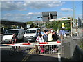
2
View of Newhaven
Looking south west from Mount Pleasant, about 55m above sea level.
The distant ferry can be seen in the centre of the picture.
Image: © Julian P Guffogg
Taken: 23 Sep 2023
0.02 miles
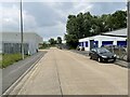
3
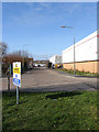
Estate Road
The end of the footpath with the entrance to Parker Pen on the left. The road eventually meets Railway Road beyond the two currently empty warehouses on the right.
Image: © Simon Carey
Taken: 21 Feb 2009
0.04 miles
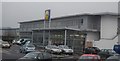
6

Estate Road
Viewed from Railway Road. Formerly used by Parker Pen until its closure in 2010 and now used as an access road for retail units that front on to Drove Road.
Image: © Simon Carey
Taken: 26 Aug 2012
0.06 miles
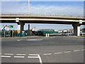
7
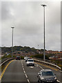
A26 terminating at the A259 overpass Newhaven
Image: © Dave Spicer
Taken: 31 May 2012
0.06 miles
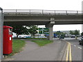
8
A259 Flyover
Built in the 1970s so any east-west traffic could avoid junctions with port traffic wanting to travel on the A26 and getting stuck at the level crossing gates next to Newhaven Town station. The original road still acts as a feeder below.
Image: © Simon Carey
Taken: 21 Feb 2009
0.07 miles
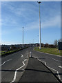
9
New Road
New in the 19th century when it was first built to enable quicker access to the Lewes-Seaford road though it wasn't until the post war period that the industrial estates were developed. The bridge was built in the 1970s as part of a scheme that included the small ring road around the High Street and carries the A259 over the A26 and its port traffic, the railway and eventually via a new swing bridge over the river.
Image: © Simon Carey
Taken: 21 Feb 2009
0.07 miles