
IMAGES TAKEN NEAR TO
Susans Close, LEWES, BN8 6QE
Introduction
This page details the photographs taken nearby to Susans Close, BN8 6QE by members of the Geograph project.
The Geograph project started in 2005 with the aim of publishing, organising and preserving representative images for every square kilometre of Great Britain, Ireland and the Isle of Man.

There are currently over 7.5m images from over14,400 individuals and you can help contribute to the project by visiting https://www.geograph.org.uk
Image Map
Images are licensed for reuse under creativecommons.org/licenses/by-sa/2.0
Notes
- Clicking on the map will re-center to the selected point.
- The higher the marker number, the further away the image location is from the centre of the postcode.
Image Listing (198 Images Found)
Images are licensed for reuse under creativecommons.org/licenses/by-sa/2.0
Image
Details
Distance
1

Susans Close
Small cul de sac off London Road near the centre of the village.
Image: © Simon Carey
Taken: 1 Apr 2012
0.01 miles
2
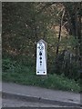
Bow Bells Milestone, East Hoathly
The 48 mile sign located near the centre of East Hoathly and one of a sequence of milestones built by the Union Point to Langney Bridge Turnpike Trust in 1754. The stretch between Hailsham and East Grinstead largely following the course of the modern A22 contains the longest sequence of milestones still extant in the country. At the top is the buckle of the Pelham family who resided in nearby Halland House and supported the construction of the turnpike, next comes the number of miles between this point and the Bow Bells of London which is depicted as a bow and three bells.
Image: © Simon Carey
Taken: 1 Apr 2012
0.01 miles
3
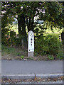
Mile marker East Hoathly
48 Miles to Bow Bells
Image: © Barry Hall
Taken: 16 Sep 2006
0.02 miles
4
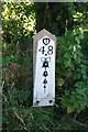
Old Milepost by London Road, East Hoathly
Metal plate attached to wooden post by the UC road (was A22), in parish of East Hoathly (Wealden District), London Road, junction with Susan's Close, near to Crockstead Hotel & Showground, on grass verge at junction, on West side of road. Bow Bells and Buckle iron plate, erected by the Horsebridge & Horeham turnpike trust in the 19th century.
Inscription reads:-
{Pelham Buckle}
48
{Bow & 4 Bells}
East Sussex HER.
HER Ref: MES33241 https://www.heritagegateway.org.uk/Gateway/Results_Single.aspx?uid=MES33241&resourceID=1026
Milestone Society National ID: SX_LLE48
Image: © Keith Sharp
Taken: 28 Jul 2012
0.02 miles
5

Post Office, High Street
The village's Post Office is right on the bend of High Street and London Road which until the late 1980s was the main A22, the 90 degree bend causing all manner of problems. Today the street is a quiet backwater thanks to the bypassing of the trunk road.
Image: © Simon Carey
Taken: 28 Jan 2007
0.02 miles
6

6-10 High Street
Dating from the 18th century these cottages were originally one building from which diarist Thomas Turner operated his village shop from 1750 until his death in 1793. See Image for more about Turner.
Image: © Simon Carey
Taken: 1 Apr 2012
0.03 miles
8

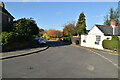
London Road
Until 1992 this ninety degree turn from High Street into London Road was the main A22 until relieved by the construction of the bypass. Now the centre of the village is a pleasant backwater with little traffic and has allowed some urban landscaping next to the remaining village shops. The road was once part of the London to Eastbourne turnpike opened in 1754 and the old tollhouse still stands to the right.
Image: © Simon Carey
Taken: 10 Apr 2012
0.03 miles

10
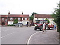
East Hoathly village centre, East Sussex
As with nearly all Sussex town and village names ending in 'y', the pronunciation is East Hoath-lye.
Image: © nick macneill
Taken: 20 Jul 2010
0.03 miles