
IMAGES TAKEN NEAR TO
Whitesmith, LEWES, BN8 6JB
Introduction
This page details the photographs taken nearby to BN8 6JB by members of the Geograph project.
The Geograph project started in 2005 with the aim of publishing, organising and preserving representative images for every square kilometre of Great Britain, Ireland and the Isle of Man.

There are currently over 7.5m images from over14,400 individuals and you can help contribute to the project by visiting https://www.geograph.org.uk
Image Map
Images are licensed for reuse under creativecommons.org/licenses/by-sa/2.0
Notes
- Clicking on the map will re-center to the selected point.
- The higher the marker number, the further away the image location is from the centre of the postcode.
Image Listing (19 Images Found)
Images are licensed for reuse under creativecommons.org/licenses/by-sa/2.0
Image
Details
Distance
1

The Woodlands Centre
The large building at the far end is a composting centre whilst to the immediate right is a timber yard. The former was opened in the last couple of years whilst the latter has been here at the most since the 1980s. Both occupy a field known in Chiddingly's 1839 tithe map as Pit's Field.
Image: © Simon Carey
Taken: 11 Feb 2012
0.03 miles
2

A22 - entrance to the Woodland Centre
All of the listed enterprises on the board for this industrial area seem by their name to have something to do with forestry except Day Aggregates.
Image: © Robin Webster
Taken: 17 Nov 2011
0.07 miles
3

Wines Field
The name of the field according to Chiddingly's 1839 tithe map with the composting plant of Image beyond.
Image: © Simon Carey
Taken: 22 Jan 2012
0.08 miles
4

The Woodlands Centre
A view of a large indoor composting centre built in the last couple of years to recycle garden waste from around the county. The Woodlands centre itself is a small business park that also contains a timber merchants.
Image: © Simon Carey
Taken: 22 Jan 2012
0.09 miles
5

Ripe Field
The name of the field according to Chiddingly's 1839 tithe map with Randall's Farm on the A22 beyond the hedgerow at the bottom of the field to the left and Upper Vert Wood on the horizon to the right.
Image: © Simon Carey
Taken: 22 Jan 2012
0.13 miles
6
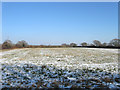
Ripe Field
The name of the field according to Chiddingly's 1839 tithe map. This is the opposite view of Image from the A22.
Image: © Simon Carey
Taken: 11 Feb 2012
0.14 miles
7

A22, Whitesmith
Following the road as it travels through Kiln Wood towards Whitesmith.
Image: © Simon Carey
Taken: 11 Feb 2012
0.14 miles
8

Randalls Farm
Next to the A22 approaching the centre of Whitesmith.
Image: © Simon Carey
Taken: 11 Feb 2012
0.14 miles
9

Whites Field
The name of the field according to Chiddingly's 1839 tithe map viewed from the footpath that links Burgh Hill to Whitesmith.
Image: © Simon Carey
Taken: 22 Jan 2012
0.16 miles
10

Shelf Wood
Very much a private wood with plenty of barbed wire to keep the unwanted out. Viewed from a point next to the footpath that links Burgh Hill to Whitesmith.
Image: © Simon Carey
Taken: 22 Jan 2012
0.17 miles