IMAGES TAKEN NEAR TO
Hamsey Road, LEWES, BN8 5TG
Introduction
This page details the photographs taken nearby to Hamsey Road, BN8 5TG by members of the Geograph project.
The Geograph project started in 2005 with the aim of publishing, organising and preserving representative images for every square kilometre of Great Britain, Ireland and the Isle of Man.

There are currently over 7.5m images from over14,400 individuals and you can help contribute to the project by visiting https://www.geograph.org.uk
Image Map
Images are licensed for reuse under creativecommons.org/licenses/by-sa/2.0
Notes
- Clicking on the map will re-center to the selected point.
- The higher the marker number, the further away the image location is from the centre of the postcode.
Image Listing (21 Images Found)
Images are licensed for reuse under creativecommons.org/licenses/by-sa/2.0
Image
Details
Distance
1
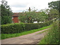
Lewesland Cottage
A late 18th century cottage viewed from Hamsey Road.
Image: © Simon Carey
Taken: 29 Dec 2008
0.02 miles
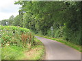
3
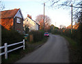
Hamsey Road
Between here and Pound Corner much of the road is lined by modern housing with one or two older cottages in between.
Image: © Simon Carey
Taken: 29 Dec 2008
0.03 miles
4
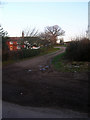
Minor road, Pound Corner, Barcombe Cross
Image: © nick macneill
Taken: 14 Mar 2012
0.04 miles
5
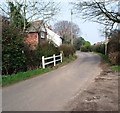
Public footpath south of Barcombe Cross
Image: © nick macneill
Taken: 14 Mar 2012
0.04 miles
7
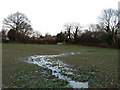
Surface Water, Road Mead
Not sure if a new spring has pushed its way to the surface or the field's drainage could not cope with the recent rains. The water rises from this hole and is making its own path down the field towards Hamsey Road.
Image: © Simon Carey
Taken: 6 Dec 2009
0.07 miles
8
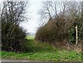
Footpath to Hamsey Road
Following the course of a former field boundary that was once separated by a small shaw, to the left was Road Mead to the right Road Field. Both have now been amalgamated though the division between the latter and Four Acre Mead still exists.
Image: © Simon Carey
Taken: 29 Dec 2008
0.10 miles
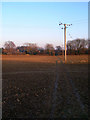
9
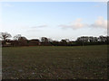
Road Mead
The name of the field according to the 1839 tithe map. The houses beyond are in Hamsey Road.
Image: © Simon Carey
Taken: 6 Dec 2009
0.10 miles
10
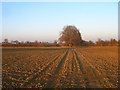
Road Mead
Former field name of a now much larger field including many others. Viewed from the footpath to Hamsey Road.
Image: © Simon Carey
Taken: 29 Dec 2008
0.13 miles