IMAGES TAKEN NEAR TO
Hamsey, LEWES, BN8 5TB
Introduction
This page details the photographs taken nearby to BN8 5TB by members of the Geograph project.
The Geograph project started in 2005 with the aim of publishing, organising and preserving representative images for every square kilometre of Great Britain, Ireland and the Isle of Man.

There are currently over 7.5m images from over14,400 individuals and you can help contribute to the project by visiting https://www.geograph.org.uk
Image Map
Images are licensed for reuse under creativecommons.org/licenses/by-sa/2.0
Notes
- Clicking on the map will re-center to the selected point.
- The higher the marker number, the further away the image location is from the centre of the postcode.
Image Listing (119 Images Found)
Images are licensed for reuse under creativecommons.org/licenses/by-sa/2.0
Image
Details
Distance
2
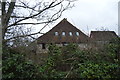
Great North Barn
Former barn belonging to Hamsey Place Farm now converted to residential use. Taken from the lane leading to the church.
Image: © Simon Carey
Taken: 29 Dec 2008
0.01 miles
3
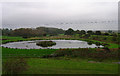
New Pond, Hamsey
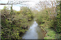
Not yet marked on the map the pond is in the 'v' between the channel of the Ouse on the left (behind the bushes) and the embankment of the former railway to the right. The former railway was not actually the original route into Lewes, this follows the line of trees to the right. The route went to Uckfield but was closed during the Beeching Cuts due to flooding problems. There are still ongoing efforts to reconnect the terminus at Uckfield with Lewes again, if this happens the original route would be used connecting with the Lewes-Wivelsfield spur line near Pellbrook Cut.
Image: © Simon Carey
Taken: 26 Oct 2005
0.01 miles
5
The Key To The Door
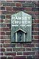
To enter Hamsey Church in 1965, you had to collect the key from the wall of a farm building at Hamsey Place Farm as you passed through on your way to the church.
Image: © Peter Jeffery
Taken: Unknown
0.03 miles
6
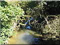
Overgrown section of the canalised River Ouse
Image: © Dave Spicer
Taken: 25 Sep 2010
0.03 miles
7

Hamsey Place Farm, Ivor's Lane, Hamsey
My car is on a bridge that crosses a cut of the River Ouse.
Image: © Kevin Gordon
Taken: 18 Oct 2008
0.03 miles
8
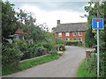
Hamsey Place Farmhouse
Grade II* listed http://list.english-heritage.org.uk/resultsingle.aspx?uid=1274819
Image: © Oast House Archive
Taken: 21 Jul 2012
0.04 miles
9
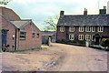
Hamsey Place Farm
Note, to the left of the photo, the board on the wall of the farm building directly above the drain outlet. If at the time of my visit, you wanted to enter Hamsey Church you had to collect the church key from this board.
Image: © Peter Jeffery
Taken: Unknown
0.04 miles