
IMAGES TAKEN NEAR TO
Mill Road, LEWES, BN8 5HY
Introduction
This page details the photographs taken nearby to Mill Road, BN8 5HY by members of the Geograph project.
The Geograph project started in 2005 with the aim of publishing, organising and preserving representative images for every square kilometre of Great Britain, Ireland and the Isle of Man.

There are currently over 7.5m images from over14,400 individuals and you can help contribute to the project by visiting https://www.geograph.org.uk
Image Map
Images are licensed for reuse under creativecommons.org/licenses/by-sa/2.0
Notes
- Clicking on the map will re-center to the selected point.
- The higher the marker number, the further away the image location is from the centre of the postcode.
Image Listing (53 Images Found)
Images are licensed for reuse under creativecommons.org/licenses/by-sa/2.0
Image
Details
Distance
1
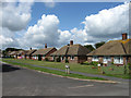
Mill Road
Bungalows built in the 1950s line the northern side of the road which links Shepherds Way with Springett Avenue.
Image: © Simon Carey
Taken: 25 Jul 2009
0.02 miles
2
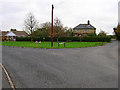
Rushy Green, Ringmer
Taken from Gote Lane looking east, to the left is Harrisons Lane to the right Potato Lane.
Image: © Simon Carey
Taken: 13 Nov 2005
0.07 miles
3
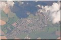
Lewes District : Ringmer Scenery
Looking down to Ringmer from a plane above it.
Image: © Lewis Clarke
Taken: 23 Aug 2012
0.09 miles
4
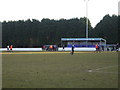
Football match, Ringmer Football Club
The game is between Ringmer and Mile Oak, a game which the home team in blue won three goals to nil.
Image: © nick macneill
Taken: 5 Mar 2009
0.09 miles
5
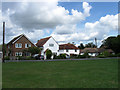
Rushy Green
A small hamlet that has now become a suburb of Ringmer. There is a small green next to the junctions of Potato Lane and Harrisons Lane with this view of the houses on the latter.
Image: © Simon Carey
Taken: 25 Jul 2009
0.09 miles
6
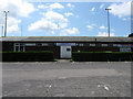
The Caburn
Home to Ringmer FC currently residing in Sussex County League One. The club's greatest season was 1970-71 when it won the Sussex League One championship for the only time and became the first village team to reach the FA Cup first round going down 3-0 to Colchester who would later knock out Don Revie's Leeds United on the way to the Sixth Round. In recent years an attempt to move up the non-league pyramid ended in administration and battles over the ownership of the ground which lies in the centre of the village on prime building land. Viewed from the car park at the front of the social club.
Image: © Simon Carey
Taken: 25 Jul 2009
0.11 miles
7
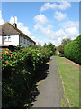
Shepherds Way
The houses on the left of the footpath are numbered for that road but are located on a footpath linking Shepherds Way with Fairlight Field.
Image: © Simon Carey
Taken: 25 Jul 2009
0.12 miles
8
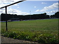
Anchor Field , home of Ringmer Football Club.
The photo is not wonky, there is a considerable slope of the pitch. The game was an action packed 3 - 6 loss for the home side against league leaders Wick FC.
Image: © nick macneill
Taken: 12 Sep 2009
0.12 miles
9
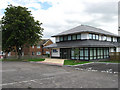
Anchor Field Surgery
Opened in June 2009 to serve the growing population of Ringmer. Located next to the football ground.
Image: © Simon Carey
Taken: 2 Aug 2009
0.12 miles
10
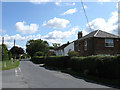
Gote Lane
An old rural lane that currently provides the southern boundary of the village of Ringmer. Taken at the junction with Springett Avenue the building on the right is Navigator's House a possible allusion to the builders of the nearby railways who were based in the village at the time of their construction.
Image: © Simon Carey
Taken: 25 Jul 2009
0.12 miles