IMAGES TAKEN NEAR TO
Langham Close, LEWES, BN8 5HL
Introduction
This page details the photographs taken nearby to Langham Close, BN8 5HL by members of the Geograph project.
The Geograph project started in 2005 with the aim of publishing, organising and preserving representative images for every square kilometre of Great Britain, Ireland and the Isle of Man.

There are currently over 7.5m images from over14,400 individuals and you can help contribute to the project by visiting https://www.geograph.org.uk
Image Map
Images are licensed for reuse under creativecommons.org/licenses/by-sa/2.0
Notes
- Clicking on the map will re-center to the selected point.
- The higher the marker number, the further away the image location is from the centre of the postcode.
Image Listing (38 Images Found)
Images are licensed for reuse under creativecommons.org/licenses/by-sa/2.0
Image
Details
Distance
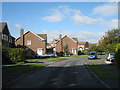
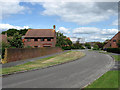
2
Sadlers Way
Housing estate built in the 1980s to fill the ever diminishing gaps in the land bounded by Lewes Road, Harrisons Lane, Gote Lane and New Road.
Image: © Simon Carey
Taken: 25 Jul 2009
0.06 miles
3
Springett Avenue
Linking Gote Lane and Lewes Road and the major arterial road through the modern part of the village.
Image: © Simon Carey
Taken: 25 Jul 2009
0.06 miles
4
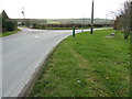
Gote Lane
With East Gote Cottage in the background. The lane forms the southern boundary of Ringmer village linking New Road with Rushey Green.
Image: © Simon Carey
Taken: 2 Aug 2009
0.08 miles
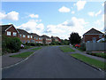
6
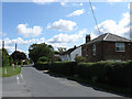
Southern edge of Ringmer
The houses are on Gote Lane.
Image: © Dave Spicer
Taken: 24 Dec 2011
0.09 miles
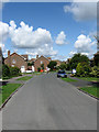
7
Sadlers Way
Housing estate built in the 1980s. The road itself links Springett Avenue with Gote Lane.
Image: © Simon Carey
Taken: 2 Aug 2009
0.09 miles
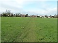
9
Barn Field
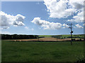
The name of the field according to the 1839 tithe map and the most popular name in the parish with 21 in total. The field beyond is Lintles marking the beginning of the chalk downs and Malling Hill in particular.
Image: © Simon Carey
Taken: 2 Aug 2009
0.11 miles
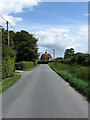
10
Gote Lane
An old rural lane that currently provides the southern boundary of the village of Ringmer. Taken at the junction with Springett Avenue the building on the right is Navigator's House a possible allusion to the builders of the nearby railways who were based in the village at the time of their construction.
Image: © Simon Carey
Taken: 25 Jul 2009
0.11 miles