
IMAGES TAKEN NEAR TO
Byron Close, LEWES, BN8 5FQ
Introduction
This page details the photographs taken nearby to Byron Close, BN8 5FQ by members of the Geograph project.
The Geograph project started in 2005 with the aim of publishing, organising and preserving representative images for every square kilometre of Great Britain, Ireland and the Isle of Man.

There are currently over 7.5m images from over14,400 individuals and you can help contribute to the project by visiting https://www.geograph.org.uk
Image Map
Images are licensed for reuse under creativecommons.org/licenses/by-sa/2.0
Notes
- Clicking on the map will re-center to the selected point.
- The higher the marker number, the further away the image location is from the centre of the postcode.
Image Listing (40 Images Found)
Images are licensed for reuse under creativecommons.org/licenses/by-sa/2.0
Image
Details
Distance
1
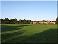
Bishop's Field
The name given to the field according to the 1839 tithe map. Part has been given over to housing with Norlington Court being the small estate in view.
Image: © Simon Carey
Taken: 25 Jul 2009
0.06 miles
2
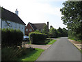
Norlington Lane
With the entrance to Norlington Court on the left and that with Bishop's Lane further on. Norlington Court is a recent construction built on the site of a former abattoir.
Image: © Simon Carey
Taken: 8 Aug 2009
0.07 miles
4
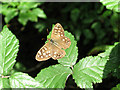
Speckled Wood Butterfly (Pararge aegeria)
On a leaf on foliage lining the north side of Bishop's Lane.
Image: © Simon Carey
Taken: 8 Aug 2009
0.10 miles
5
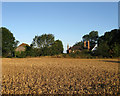
Norlington Farm
View in the early morning light from the footpath that links Bishop's Lane with Norlington Lane.
Image: © Simon Carey
Taken: 25 Jul 2009
0.10 miles
6
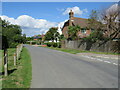
Norlington Lane, Ringmer
Norlington Lane is a minor road in the village of Ringmer, in East Sussex.
Image: © Malc McDonald
Taken: 29 Aug 2022
0.11 miles
7
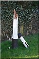
Old Direction Sign - Signpost by Norlington Lane, Ringmer parish
Black iron cap finial - lost; East Sussex wood by the UC road, in parish of Ringmer (Lewes District), missing Three in March 2011 (see Google Earth), on verge opposite junction of Bishops Lane with Norlington Lane.
Surveyed
Milestone Society National ID: SX_TQ4412C
Image: © Milestone Society
Taken: Unknown
0.11 miles
8
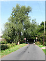
Pinch Point, Bishop's Lane
Probably to prevent lorries from nearby Diplocks Industrial Estate using them. Transit vans need to pull their mirrors in to squeeze through.
Image: © Simon Carey
Taken: 8 Aug 2009
0.12 miles
9
Norlington Fields
Small cul-de-sac built in the 1980s on the northern edge of the village.
Image: © Simon Carey
Taken: 8 Aug 2009
0.13 miles
10
Christie Avenue
Part of a small housing estate built in the former grounds of Delves House in the early 1970s.
Image: © Simon Carey
Taken: 8 Aug 2009
0.14 miles