
IMAGES TAKEN NEAR TO
Anchor Lane, LEWES, BN8 5EA
Introduction
This page details the photographs taken nearby to Anchor Lane, BN8 5EA by members of the Geograph project.
The Geograph project started in 2005 with the aim of publishing, organising and preserving representative images for every square kilometre of Great Britain, Ireland and the Isle of Man.

There are currently over 7.5m images from over14,400 individuals and you can help contribute to the project by visiting https://www.geograph.org.uk
Image Map
Images are licensed for reuse under creativecommons.org/licenses/by-sa/2.0
Notes
- Clicking on the map will re-center to the selected point.
- The higher the marker number, the further away the image location is from the centre of the postcode.
Image Listing (33 Images Found)
Images are licensed for reuse under creativecommons.org/licenses/by-sa/2.0
Image
Details
Distance
3
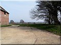
Access road, Delves Farm near Barcombe Cross
Image: © nick macneill
Taken: 14 Mar 2012
0.02 miles
4

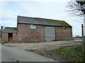
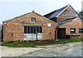
Barn at Delves Farm, Anchor Lane, Barcombe, East Sussex
Image: © Oast House Archive
Taken: 19 Sep 2008
0.02 miles
5
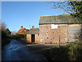
Delves Farm
The farm buildings in the foreground are currently empty and await planning permission for either conversion or demolition. Beyond is the farmhouse that dates from the late 16th century.
Image: © Simon Carey
Taken: 6 Dec 2009
0.02 miles
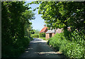
7
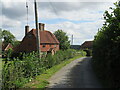
Anchor Lane, near Barcombe Cross
Anchor Lane is a minor lane through East Sussex countryside. Here it passes Delves Farm.
Image: © Malc McDonald
Taken: 29 Aug 2022
0.03 miles
8
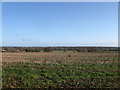
Hemp Plat
The name of this section of the modern field according to the 1839 tithe map that has been extended eastwards to include Hawkins Field, Great Hawkins and Hall Hand Field. The ground drops in the near distance to accommodate the River Ouse's flood plain whilst beyond is the Weald to the north of Ringmer.
Image: © Simon Carey
Taken: 6 Dec 2009
0.05 miles
9
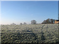
Wainhouse Meadow
The name of the field according to Barcombe's 1839 tithe map with Image on the right.
Image: © Simon Carey
Taken: 19 Mar 2011
0.05 miles
10
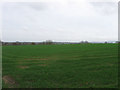
Great Hawkins
The name of the field according to Barcombe's 1839 tithe map that has been extended to include a number of others and viewed from the footpath that links Anchor Lane to Barcombe Cross.
Image: © Simon Carey
Taken: 3 Apr 2011
0.06 miles