
IMAGES TAKEN NEAR TO
Bridgelands, LEWES, BN8 5BW
Introduction
This page details the photographs taken nearby to Bridgelands, BN8 5BW by members of the Geograph project.
The Geograph project started in 2005 with the aim of publishing, organising and preserving representative images for every square kilometre of Great Britain, Ireland and the Isle of Man.

There are currently over 7.5m images from over14,400 individuals and you can help contribute to the project by visiting https://www.geograph.org.uk
Image Map
Images are licensed for reuse under creativecommons.org/licenses/by-sa/2.0
Notes
- Clicking on the map will re-center to the selected point.
- The higher the marker number, the further away the image location is from the centre of the postcode.
Image Listing (61 Images Found)
Images are licensed for reuse under creativecommons.org/licenses/by-sa/2.0
Image
Details
Distance
1
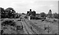
Barcombe Station (remains)
View northward, towards East Grinstead; East Grinstead - Horsted Keynes - Lewes line - nowadays the thriving Bluebell Railway, Sheffield Park - Kingscote (presently East Grinstead). The line, and Barcombe station first closed 13/6/55, but closure later deemed illegal and the line was reopened 7/8/56 until eventual closure on 17/3/58. The Bluebell Railway reopened Horsted Keynes - Sheffield Park in 1960.
Image: © Ben Brooksbank
Taken: 18 Jun 1961
0.04 miles
2

Former Barcombe Station
Another view of Image from the former railway bridge. The platforms are still visible but the track has been filled in and turned into a garden.
Image: © Simon Carey
Taken: 6 Jan 2008
0.04 miles
3

Barcombe Railway station ..... now a private house
As it appeared after the close of the railway and before conversion to a private dwelling can be seen via this link. Image
Image: © Colin Vosper
Taken: 27 Jan 2010
0.04 miles
4

Former Barcombe Station
Barcombe parish contained two stations, one at the edge of Barcombe Cross and another further east at Barcombe Mills. This station was on the Lewes-East Grinstead, part of which is now the Bluebell Railway, which opened in 1882 and was closed in 1958. The station house is now a private residence.
Image: © Simon Carey
Taken: 6 Jan 2008
0.04 miles
5

Once the track and platform at Barcombe station
The platform edge is the only visible sign left. The converted station, now a private house is further along the garden.
Image: © Dave Spicer
Taken: 25 Sep 2010
0.04 miles
6

Hovel Field
Viewed from the lane near Pound Corner with Barcombe's former station building visible through the trees and the course of the line can be made out heading north.
Image: © Simon Carey
Taken: 29 Dec 2008
0.06 miles
7

Barn Field
Named as such on the 1841 tithe map. The former field boundary has been grubbed but the course can still be made out. The field has also been truncated since then by the arrival of the Lewes-East Grinstead which opened in 1883 and closed in 1958, its course marked by the foliage on the right. A glasshouse from Hillside Nursery can be seen in the distance.
Image: © Simon Carey
Taken: 12 Jul 2009
0.09 miles
8

Willow Cottage, High Street
Originally the land was waste beside the highway that was inclosed in the late 18th century. It was recorded as a garden in 1840 and the cottage was built in 1873-4. Beyond is the remnant of Ten Acre Field much of which is now occupied by housing.
Image: © Simon Carey
Taken: 29 Dec 2008
0.09 miles
9

Barcombe .... the old railway bridge
The old railway track used to pass under the road bridge and as shown in this photo this route is now blocked up, probably for safety reasons. No doubt once the scene of steam trains belching smoke to the amazement and delight of onlookers, but now the railway track is gone along with the tunnel. The different coloured brickworks indicates where the trains used to run under the bridge as they arrived or departed from Barcombe station.
Image: © Colin Vosper
Taken: 27 Jan 2010
0.10 miles
