
IMAGES TAKEN NEAR TO
South Chailey, LEWES, BN8 4QD
Introduction
This page details the photographs taken nearby to BN8 4QD by members of the Geograph project.
The Geograph project started in 2005 with the aim of publishing, organising and preserving representative images for every square kilometre of Great Britain, Ireland and the Isle of Man.

There are currently over 7.5m images from over14,400 individuals and you can help contribute to the project by visiting https://www.geograph.org.uk
Image Map
Images are licensed for reuse under creativecommons.org/licenses/by-sa/2.0
Notes
- Clicking on the map will re-center to the selected point.
- The higher the marker number, the further away the image location is from the centre of the postcode.
Image Listing (11 Images Found)
Images are licensed for reuse under creativecommons.org/licenses/by-sa/2.0
Image
Details
Distance
1
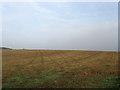
The Knowle
The name of the field according to the 1844 tithe map that was once part of a medieval deer park that was enclosed in the mid 17th century. The field has now been enlarged to include Long Croft and Rail Mead to the south west. Taken from a permissive bridleway that circuits the fields belonging to Bevern Farm.
Image: © Simon Carey
Taken: 30 Oct 2009
0.11 miles
2
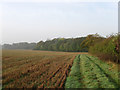
Permissive Bridleway, Bevern Farm
Following a number of circuits around fields east and west of the A275. See http://cwr.naturalengland.org.uk/DisplayImage.aspx?Type=Mapboard&IFN=ag00178317.pdf for the map. Wickham Wood is at the end of the field.
Image: © Simon Carey
Taken: 30 Oct 2009
0.13 miles
3
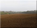
The North Field
The name of the field according to the 1844 tithe map that lies at the northern tip of the parish of St John (Without). It was once part of a medieval deer park that was enclosed in the mid 17th century and can now be viewed from a permissive bridleway that circuits a number of fields belonging to Bevern Farm. The early morning haze is still causing problems with visibility.
Image: © Simon Carey
Taken: 30 Oct 2009
0.14 miles
4

Wickham Wood
Dropping down towards Bevern Stream which lies out of shot to the right.
Image: © Simon Carey
Taken: 30 Oct 2009
0.19 miles
5
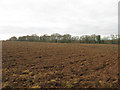
Field near Bevern Bridge
No name was given to this field in Hamsey's 1840 tithe map. The field itself is not that old, a 1752 estate map has this as part of Lower Alford's Wood most of which was grubbed in the early 19th century with only Kiln Wood, River Wood and the shaw in view separating the field from the A275 remaining. Viewed from a permissive bridleway that is part of a number of paths on Bevern Bridge Farm that straddles the A275 south of Bevern Stream.
Image: © Simon Carey
Taken: 2 Jan 2011
0.20 miles
6
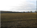
Cottage Field
The name of the field according to Hamsey's 1840 tithe map that has been extended to include Little Gate Field to the south. Folly Wood is also in view.
Image: © Simon Carey
Taken: 2 Jan 2011
0.22 miles
7

Long Croft
The name of this section of the field according to the 1844 tithe map that has been enlarged to include Rail Mead to the west and The Knowle to the north. Much of these changes have occurred only in the last thirty years. Taken from a permissive bridleway that runs a circuit around the land owned by Bevern Farm to the west of the A275. Wickham Wood is on the far side of the field still partially obscured by the early morning mist.
Image: © Simon Carey
Taken: 30 Oct 2009
0.22 miles
8

The Moor
The name of the field according to the 1844 tithe map that was once part of a medieval deer park that was enclosed in the mid 17th century. The haze caused by week sunlight and lingering early morning mist gives an almost bleaching effect to the field in the distance. Taken from a permissive bridleway that circuits the land owned by Bevern Farm to the west of the A275.
Image: © Simon Carey
Taken: 30 Oct 2009
0.23 miles
9
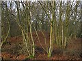
Mound, Kiln Wood
The wood forms part of the site of Old Hamsey Brickworks which operated on the site from Victorian times until its closure in 1989. Kiln Wood itself was originally part of a much larger Lower Alford's Wood that covered both Image and Image until the early 19th century when much of it was grubbed.
Image: © Simon Carey
Taken: 2 Jan 2011
0.23 miles
10
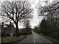
A275 at Bevern Bridge
The Lewes to East Grinstead road is of some antiquity as south of Bevern Bridge it forms the parish boundary between Hamsey to the east and St John sub Castro to the west. Bevern Bridge Farm is to the left.
Image: © Simon Carey
Taken: 2 Jan 2011
0.24 miles