
IMAGES TAKEN NEAR TO
Warrs Hill Road, LEWES, BN8 4JF
Introduction
This page details the photographs taken nearby to Warrs Hill Road, BN8 4JF by members of the Geograph project.
The Geograph project started in 2005 with the aim of publishing, organising and preserving representative images for every square kilometre of Great Britain, Ireland and the Isle of Man.

There are currently over 7.5m images from over14,400 individuals and you can help contribute to the project by visiting https://www.geograph.org.uk
Image Map
Images are licensed for reuse under creativecommons.org/licenses/by-sa/2.0
Notes
- Clicking on the map will re-center to the selected point.
- The higher the marker number, the further away the image location is from the centre of the postcode.
Image Listing (52 Images Found)
Images are licensed for reuse under creativecommons.org/licenses/by-sa/2.0
Image
Details
Distance
1
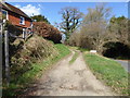
Footpath beside Blackbrook Lane passes Rock Cottage
The path is in West Sussex but the road is in East Sussex.
See also http://www.geograph.org.uk/photo/1951118.
Image: © Shazz
Taken: 21 Mar 2017
0.01 miles
2

Hop Garden
The name of the field according to the 1838 tithe map and a reminder of a previous use from an era when small hop gardens abounded in this part of the world.
Image: © Simon Carey
Taken: 30 Jan 2011
0.01 miles
3

Footpath to Lindfield Farm off Blackbrook Lane
Image: © N Chadwick
Taken: 15 May 2010
0.02 miles
4

Footpath branching away from Blackbrook Lane
Image: © Dave Spicer
Taken: 4 Jul 2009
0.02 miles
5

Rock Cottage
On the Lindfield side of Blackbrook Lane next to the drive to Lindfield Farm which is also a public footpath.The cottage was built in the first decade of the 20th century and as named after an old quarry which was once located out of shot to the right.
Image: © Simon Carey
Taken: 30 Jan 2011
0.04 miles
6

Looking across junction of private road with Blackbrook Lane
Image: © Shazz
Taken: 21 Mar 2017
0.06 miles
7

Footpath goes west to Lindfield Farm
This picture is in West Sussex.
Image: © Shazz
Taken: 21 Mar 2017
0.06 miles


10

Three Acres
The name of the field according to Lindfield's 1845 tithe map that is bounded by Pellingford Brook and Image to the north, Blackbrook Lane to the east and the access road to Lindfield Farm to the north.
Image: © Simon Carey
Taken: 22 Aug 2015
0.07 miles