
IMAGES TAKEN NEAR TO
Allington Lane, LEWES, BN7 3QL
Introduction
This page details the photographs taken nearby to Allington Lane, BN7 3QL by members of the Geograph project.
The Geograph project started in 2005 with the aim of publishing, organising and preserving representative images for every square kilometre of Great Britain, Ireland and the Isle of Man.

There are currently over 7.5m images from over14,400 individuals and you can help contribute to the project by visiting https://www.geograph.org.uk
Image Map
Images are licensed for reuse under creativecommons.org/licenses/by-sa/2.0
Notes
- Clicking on the map will re-center to the selected point.
- The higher the marker number, the further away the image location is from the centre of the postcode.
Image Listing (20 Images Found)
Images are licensed for reuse under creativecommons.org/licenses/by-sa/2.0
Image
Details
Distance

2
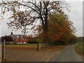
Allington Farmhouse
No longer the house of a working farm, many of its outbuildings have now been converted to small business units. Allington Lane is on the right.
Image: © Simon Carey
Taken: 30 Oct 2009
0.02 miles
3
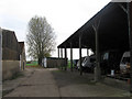
Outbuildings, Allington Farm
Now given over to small business units. Taken from the bridleway that links Allington Lane to Novington Lane.
Image: © Simon Carey
Taken: 30 Oct 2009
0.03 miles
4
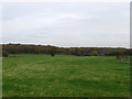
Kitchen Mead
The name of this section of the field according to the 1844 tithe map that has now been extended northwards to include Pond Field which in turn has Warningore Wood behind it. The house on the right is Allington Lodge.
Image: © Simon Carey
Taken: 30 Oct 2009
0.06 miles
5
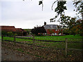
Allington Farm
Looking north east from the junction of Allington Lane and the Bridleway.
Image: © Simon Carey
Taken: 26 Oct 2005
0.08 miles
6
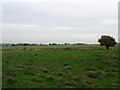
Fountain Meadow
The name of the field according to the 1844 tithe map that roughly corresponds to this modern paddock. The two oaks in the distance on the left are remnants of a former hedgerow and also the parish boundary between St John (Without) and Hamsey.
Image: © Simon Carey
Taken: 30 Oct 2009
0.08 miles
8
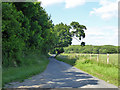
Allington Lane
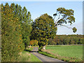
Towards Allington Farm and Chiltington. That tree still has a strange shape - see Image
Image: © Robin Webster
Taken: 22 Jun 2019
0.08 miles
9
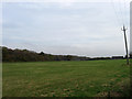
Blackham Mead
The name of the field according to the 1844 tithe map. Warningore Wood is on the left with the cottages on Allington Lane to the right and the upper floor and roof of Allington Lodge to the left.
Image: © Simon Carey
Taken: 30 Oct 2009
0.10 miles
10
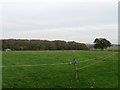
Court Woods
The name of the field according to the 1844 tithe map which also gave its usage as pasture. The field is also marked on the 1778 Yeakell & Gardner map which suggests a grubbing up occurred some time before with the land keeping the name of a former wood. The eastern end of Warningore Wood is beyond with the roof of Allington Lodge to the left.
Image: © Simon Carey
Taken: 30 Oct 2009
0.11 miles