IMAGES TAKEN NEAR TO
Wales Farm Lane, LEWES, BN7 3AS
Introduction
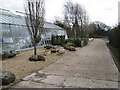
This page details the photographs taken nearby to Wales Farm Lane, BN7 3AS by members of the Geograph project.
The Geograph project started in 2005 with the aim of publishing, organising and preserving representative images for every square kilometre of Great Britain, Ireland and the Isle of Man.

There are currently over 7.5m images from over14,400 individuals and you can help contribute to the project by visiting https://www.geograph.org.uk
Image Map
Images are licensed for reuse under creativecommons.org/licenses/by-sa/2.0
Notes
- Clicking on the map will re-center to the selected point.
- The higher the marker number, the further away the image location is from the centre of the postcode.
Image Listing (75 Images Found)
Images are licensed for reuse under creativecommons.org/licenses/by-sa/2.0
Image
Details
Distance
1
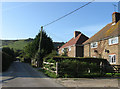
Wales Farm Road
The lane linking both Wales Farm and the western parts of Plumpton College with the B2116.
Image: © Simon Carey
Taken: 26 Sep 2009
0.02 miles
2
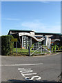
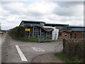
Wine Science Centre, Plumpton College
Recently opened building to house the growing department of viticulture. The college produces its own wine from vines grown on its estate by the students.
Image: © Simon Carey
Taken: 26 Sep 2009
0.02 miles
3
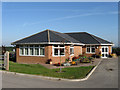
Horticulture Department, Plumpton College
Located at the junction of Wales Farm Road and the access road to St Michael's church.
Image: © Simon Carey
Taken: 26 Sep 2009
0.06 miles
4
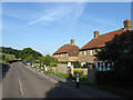
Tenby Cottages, Ditchling Road
Small group of cottages to the south east of Plumpton College and the western most point of the village of Plumpton. Possibly built to provide accommodation for agricultural workers of nearby Wales Farm or the college itself.
Image: © Simon Carey
Taken: 26 Sep 2009
0.06 miles
5
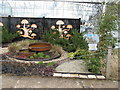
Building at Plumpton Agricultural College
Must have been designed along the lines of a ploughed field
Image: © Dave Spicer
Taken: 21 Mar 2010
0.06 miles
6
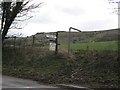
Signpost for St Michael's Church and Wales Farm
Wales Farm is part of the Plumpton Agricultural College.
Image: © Dave Spicer
Taken: 21 Mar 2010
0.07 miles
8
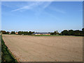
Upper Church Laine
The name of the field according to the 1839 tithe map though known as Church Field by the current owners Plumpton College. The building in the distance belongs to the college whilst the spire of St Michaels church can just be seen over the trees to the right.
Image: © Simon Carey
Taken: 26 Sep 2009
0.08 miles
10
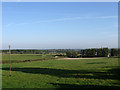
Wales Laine, Plumpton
The name of the field according to the 1839 tithe map. The hedge on the left marks the parish boundary between Plumpton and Streat.
Image: © Simon Carey
Taken: 26 Sep 2009
0.09 miles