
IMAGES TAKEN NEAR TO
Rotten Row, LEWES, BN7 1TN
Introduction
This page details the photographs taken nearby to Rotten Row, BN7 1TN by members of the Geograph project.
The Geograph project started in 2005 with the aim of publishing, organising and preserving representative images for every square kilometre of Great Britain, Ireland and the Isle of Man.

There are currently over 7.5m images from over14,400 individuals and you can help contribute to the project by visiting https://www.geograph.org.uk
Image Map
Images are licensed for reuse under creativecommons.org/licenses/by-sa/2.0
Notes
- Clicking on the map will re-center to the selected point.
- The higher the marker number, the further away the image location is from the centre of the postcode.
Image Listing (692 Images Found)
Images are licensed for reuse under creativecommons.org/licenses/by-sa/2.0
Image
Details
Distance
2
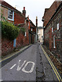
Rotten Row, Lewes
Taken from the junction with Antioch Street looking east.
Image: © Simon Carey
Taken: 13 Nov 2005
0.02 miles
3
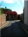
Antioch Street
In view is the length of the whole street though its medieval course is believed to have continued beyond the ivy clad wall at the far end.
Image: © Simon Carey
Taken: 7 Oct 2006
0.02 miles
4
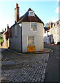
The Old Toll House, High Street
On the junction of High Street and Rotten Row. The toll house would have covered the Lewes to Brighton turnpike now the A27.
Image: © Simon Carey
Taken: 7 Oct 2006
0.02 miles
6

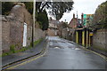
Church Lane ends at Rotten Row, Lewes
For most of its length from the High Street, Church Lane is a narrow passage with steps, seen here finishing at the narrow opening to the right of the nearest door in the wall.
Image: © Robin Webster
Taken: 20 Jul 2016
0.04 miles
7
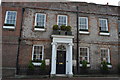
111, High St
Grade II listed. http://www.britishlistedbuildings.co.uk/en-293179-no-111-and-railings-to-north-lewes-east-
Image: © N Chadwick
Taken: 12 Jul 2015
0.05 miles
8
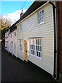
Cottages, High Street
The nearest has been weatherboarded and all three can be dated back to Georgian times.
Image: © Simon Carey
Taken: 7 Oct 2006
0.05 miles
9
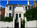
51-53 Grange Road
Victorian houses on the northern side of Grange Road. The rest of the housing on this side of the road was added later.
Image: © Simon Carey
Taken: 7 Oct 2006
0.05 miles
10
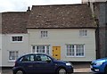
115, High St
Grade II listed. http://www.britishlistedbuildings.co.uk/en-293182-115-high-street-lewes-east-sussex
Image: © N Chadwick
Taken: 12 Jul 2015
0.05 miles