
IMAGES TAKEN NEAR TO
Ousedale Close, LEWES, BN7 1SY
Introduction
This page details the photographs taken nearby to Ousedale Close, BN7 1SY by members of the Geograph project.
The Geograph project started in 2005 with the aim of publishing, organising and preserving representative images for every square kilometre of Great Britain, Ireland and the Isle of Man.

There are currently over 7.5m images from over14,400 individuals and you can help contribute to the project by visiting https://www.geograph.org.uk
Image Map
Images are licensed for reuse under creativecommons.org/licenses/by-sa/2.0
Notes
- Clicking on the map will re-center to the selected point.
- The higher the marker number, the further away the image location is from the centre of the postcode.
Image Listing (217 Images Found)
Images are licensed for reuse under creativecommons.org/licenses/by-sa/2.0
Image
Details
Distance
1
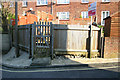
Greenwich Meridian near Abergavenny Rd, Lewes
This picture was taken standing on the Greenwich meridian looking North. The left half of the image is in the Western Hemisphere and the right is in the Eastern. The meridian passes straight through the middle, see this http://www.riddlerworld.co.uk/meridian/PG1022.htm for an alternate image with the meridian superimposed as a yellow line. The Meridian passes through a house for sale on Abergavenny Road in Lewes.
Image: © steve ridley
Taken: 8 Mar 2011
0.05 miles
2
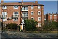
Greenwich Meridian crossing Valence rd
This picture was taken standing on the Greenwich meridian looking North. The left half of the image is in the Western Hemisphere and the right is in the Eastern. The meridian passes straight through the middle, see this http://www.riddlerworld.co.uk/meridian/PG1016.htm for an alternate image with the meridian superimposed as a yellow line. The Meridian crosses Valence Road and passes through the flats on the north side.
Image: © steve ridley
Taken: 8 Mar 2011
0.06 miles
3
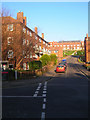
Abergavenny Road
Housing estate in the western part of Lewes. Taken from the junction with Valence Road.
Image: © Simon Carey
Taken: 29 Dec 2008
0.06 miles
4
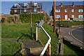
Greenwich Meridian near Abergavenny Rd
This picture was taken standing on the Greenwich meridian looking North. The left half of the image is in the Western Hemisphere and the right is in the Eastern. The meridian passes straight through the middle, see this http://www.riddlerworld.co.uk/meridian/PG1026.htm for an alternate image with the meridian superimposed as a yellow line. The Meridian passes close to Abergavenny Road in Lewes.
Image: © steve ridley
Taken: 8 Mar 2011
0.07 miles
5
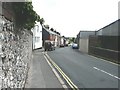
De Montfort Road, Lewes
In the far distance, the castle can just be made out.
Image: © John Baker
Taken: 3 Jul 2011
0.07 miles
6
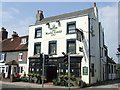
Black Horse Inn, Lewes
The Black Horse Inn in Lewes.
Image: © Malc McDonald
Taken: 17 Apr 2011
0.08 miles
7
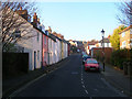
Valence Road
Taken from the junction with Abergavenny Road looking towards the point where it crosses Leicester Road. Like most roads in Wallands Park named after a person involved in the 1264 Battle of Lewes.
Image: © Simon Carey
Taken: 29 Dec 2008
0.09 miles
8
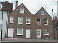
High Street, Lewes
It seem unbelievable that such a picturesque building could soon be demolished but there is a notice to this effect in the window to the right of the door with the words "danger keep out" painted on it. It is also noticeable that the window above this door is open to the elements.
Image: © John Baker
Taken: 3 Jul 2011
0.09 miles
10

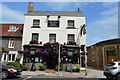
De Montfort Road, Wallands Park, Lewes
Linking Nevill Road, the A275, in the west, to a junction with Bradford Road in the east where it becomes Paddock Lane. First laid out in the early 1860s it was intermittently developed thereafter. The road marks the southern end of the Wallands Park area of Lewes which was developed over a similar period covering much of the eastern area of the Battle of Lewes, 1264, many of whose participants have had roads named after them here.
Image: © Simon Carey
Taken: 31 Aug 2025
0.10 miles