IMAGES TAKEN NEAR TO
London Road, HASSOCKS, BN6 9NT
Introduction
This page details the photographs taken nearby to London Road, BN6 9NT by members of the Geograph project.
The Geograph project started in 2005 with the aim of publishing, organising and preserving representative images for every square kilometre of Great Britain, Ireland and the Isle of Man.

There are currently over 7.5m images from over14,400 individuals and you can help contribute to the project by visiting https://www.geograph.org.uk
Image Map
Images are licensed for reuse under creativecommons.org/licenses/by-sa/2.0
Notes
- Clicking on the map will re-center to the selected point.
- The higher the marker number, the further away the image location is from the centre of the postcode.
Image Listing (12 Images Found)
Images are licensed for reuse under creativecommons.org/licenses/by-sa/2.0
Image
Details
Distance
1
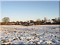
Welcome Mead
The name of the field according to the 1838 tithe map. A line of tractors are parked next to the fence separating them from the houses that front onto London Road, the A273.
Image: © Simon Carey
Taken: 20 Dec 2009
0.09 miles
3
Welcome Mead
The name of the field according to the 1838 tithe map. It is crossed by the footpath that links Hassocks with Clayton Wickham.
Image: © Simon Carey
Taken: 20 Dec 2009
0.13 miles
4
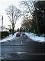
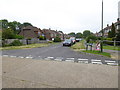
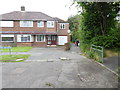
Stanford Avenue
Residential road that leaves London Road, the A273, just north of Stonepound Crossroads and heads towards Hassocks station. Like many residential roads after the snow and ice untreated and hazardous to drive on.
Image: © Simon Carey
Taken: 20 Dec 2009
0.17 miles
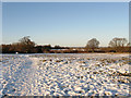
6
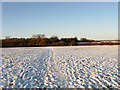
Ham Mead
The name of the field according to the 1838 tithe map and carrying the footpath that links Hassocks to Clayton Wickham.
Image: © Simon Carey
Taken: 20 Dec 2009
0.19 miles
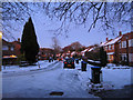
7
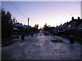
Semley Road
Taken at dusk with a crescent moon visible at the top centre left. Like all residential roads this cul-de-sac has been left untreated and is therefore covered in sheet ice.
Image: © Simon Carey
Taken: 20 Dec 2009
0.20 miles
8
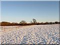
Ham Mead
The name of the field according to the 1838 tithe map which stretched beyond the modern fence up to the bushes on the left. Both they and the snow are catching the light of the setting sun.
Image: © Simon Carey
Taken: 20 Dec 2009
0.20 miles
9
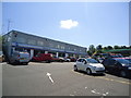
Houses at southern end of Friars Oak Road with twitten
Image: © Shazz
Taken: 22 Jun 2016
0.22 miles
10
Friars Oak Road
Residential road that starts here at the junction with Little Copse Road then heads north then west to Priory Road. Both roads and pavements are covered in sheet ice. Taken at dusk that accentuates some of the outdoor Christmas decorations.
Image: © Simon Carey
Taken: 20 Dec 2009
0.23 miles