
IMAGES TAKEN NEAR TO
Truslers Hill Lane, HASSOCKS, BN6 9DT
Introduction
This page details the photographs taken nearby to Truslers Hill Lane, BN6 9DT by members of the Geograph project.
The Geograph project started in 2005 with the aim of publishing, organising and preserving representative images for every square kilometre of Great Britain, Ireland and the Isle of Man.

There are currently over 7.5m images from over14,400 individuals and you can help contribute to the project by visiting https://www.geograph.org.uk
Image Map
Images are licensed for reuse under creativecommons.org/licenses/by-sa/2.0
Notes
- Clicking on the map will re-center to the selected point.
- The higher the marker number, the further away the image location is from the centre of the postcode.
Image Listing (24 Images Found)
Images are licensed for reuse under creativecommons.org/licenses/by-sa/2.0
Image
Details
Distance
1
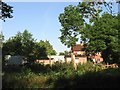
Truslers Hill Farm, Truslers Hill Lane
Marked on Yeakell & Gardner's 1778-83 map the farm seems to have been located here for quite some time. It lies on the western side of the road just north of its crossing of Cutler's Brook.
Image: © Simon Carey
Taken: 31 May 2014
0.00 miles
2

Three Acre Mead
The name of the field according to Albourne's 1839 tithe map that runs along the northern bank of Cutler's Brook from Truslers Hill Lane.
Image: © Simon Carey
Taken: 25 May 2014
0.05 miles
3
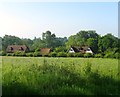
The Mill, Truslers Hill Lane
The house dates from between the wars, possibly late 1920s, after Albourne Mill, which it is named after, was closed around 1927. The latter was located amongst the trees to the south of the current building on Cutlers Brook.
Image: © Simon Carey
Taken: 31 May 2014
0.06 miles
4

Truslers Hill Lane
Looking northward along the highway that links Poynings Crossways to High Cross as it crosses Cutlers Brook. the opposite view of Image
Image: © Simon Carey
Taken: 25 May 2014
0.07 miles
5

Old Mill Pond, Albourne Mill
A mill existed on this site from the 17th century until around the late 1920s. The mill pond was long and thin and ran to the north of Cutler's Brook, this is the western end looking towards the site of the old mill. The footbridge carries the footpath from Trusler's Mill lane to Church Lane and follows the old embankment that separated the pond from the brook part of the way. See also Image
Image: © Simon Carey
Taken: 31 May 2014
0.07 miles
6

Old Sluice, Albourne Mill
A mill has occupied the spot immediately to the north east of where Cutlers Brook is crossed by Truslers Hill Lane since at least the 17th century and was still operational at the time of Albourne's 1839 tithe map continuing working until after the First World War. Just visible through the nettles is a long concrete gully where a sluice gate once existed to control outflow from a long narrow mill pond to the north with Cutler's Brook to the south.
Image: © Simon Carey
Taken: 25 May 2014
0.07 miles
7

Cutler's Brook
A tributary of the River Adur that rises near Clayton. Beyond the trees is the bridge carrying Truslers Hill Lane over the stream whilst in the foreground is part of the concrete belonging to Image
Image: © Simon Carey
Taken: 25 May 2014
0.08 miles
8

Old Sluice Gate, Albourne
Viewed from the old mill pond, the concrete sluice is all that really survives from Albourne Mill that occupied this site from the 17th century until its closure in the late 1920s. The footbridge carries the footpath from Truslers Hill Lane to Church Lane and for part of its way follows the embankment of the old pond.
Image: © Simon Carey
Taken: 31 May 2014
0.08 miles
9

Trusler's Hill Lane
The highway that links Poynings Crossways to High Cross seen here crossing Cutler's Brook.
Image: © Simon Carey
Taken: 25 May 2014
0.08 miles
10
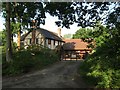
Truslers, Truslers Hill Lane
The mock tudor house was built after the Second World War in the grounds of what was another house called Truslers which later changed its name to Kingsfold.
Image: © Simon Carey
Taken: 31 May 2014
0.09 miles