IMAGES TAKEN NEAR TO
Park Avenue, HASSOCKS, BN6 8LT
Introduction
This page details the photographs taken nearby to Park Avenue, BN6 8LT by members of the Geograph project.
The Geograph project started in 2005 with the aim of publishing, organising and preserving representative images for every square kilometre of Great Britain, Ireland and the Isle of Man.

There are currently over 7.5m images from over14,400 individuals and you can help contribute to the project by visiting https://www.geograph.org.uk
Image Map
Images are licensed for reuse under creativecommons.org/licenses/by-sa/2.0
Notes
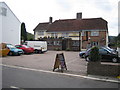
- Clicking on the map will re-center to the selected point.
- The higher the marker number, the further away the image location is from the centre of the postcode.
Image Listing (108 Images Found)
Images are licensed for reuse under creativecommons.org/licenses/by-sa/2.0
Image
Details
Distance
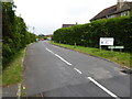
3
Lodge Lane Keymer
Footpath 12K leads off into the trees on the left.
Image: © Dave Spicer
Taken: 24 Jul 2011
0.07 miles
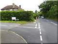
4
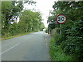
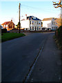
Speed limit entering Keymer
Keymer derives its name 'cy mere' meaning Cows pool and was probably a watering place for cattle.
Image: © Dave Spicer
Taken: 24 Jul 2011
0.09 miles
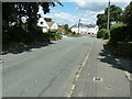
5
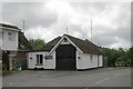
Keymer fire station
Keymer fire station, Lodge Lane, Hassocks, West Sussex
Image: © Kevin Hale
Taken: 16 Jun 2007
0.09 miles
6
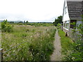
Footpath going west from Lodge Lane
The lovely South Downs are on the left skyline.
Image: © Shazz
Taken: 22 Jun 2016
0.10 miles
7
34 Lodge Lane
Former Victorian villa on the corner of Lodge Lane and Dale Avenue.
Image: © Simon Carey
Taken: 9 Feb 2008
0.11 miles
8
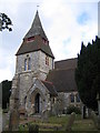
Keymer: The Church of St Cosmas and St Damian
Dedicated to twin brother doctors who were martyred in the 4th century, this church is one of only three in England to be so named. The others are at Stretford in Herefordshire Image and at Blean in Kent near Canterbury Image (I think!). This church was originally Norman but rebuilt in 1866.
Image: © Nigel Cox
Taken: 20 Aug 2006
0.15 miles
9
Keymer: The Greyhound public house
The pub is on the south side of Keymer Road, opposite Image It dates back to around the middle of the 16th century and has a fireplace dated 1595. The pub's website is here http://www.greyhoundkeymer.com/index.php
Image: © Nigel Cox
Taken: 20 Aug 2006
0.15 miles
10
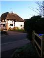
The Old Thatch, Lodge Lane
A sixteenth century cottage just south of the village centre.
Image: © Simon Carey
Taken: 9 Feb 2008
0.17 miles