
IMAGES TAKEN NEAR TO
Jack Slaughter Lane, BN6 8GF
Introduction
This page details the photographs taken nearby to Jack Slaughter Lane, BN6 8GF by members of the Geograph project.
The Geograph project started in 2005 with the aim of publishing, organising and preserving representative images for every square kilometre of Great Britain, Ireland and the Isle of Man.

There are currently over 7.5m images from over14,400 individuals and you can help contribute to the project by visiting https://www.geograph.org.uk
Image Map
Images are licensed for reuse under creativecommons.org/licenses/by-sa/2.0
Notes
- Clicking on the map will re-center to the selected point.
- The higher the marker number, the further away the image location is from the centre of the postcode.
Image Listing (10 Images Found)
Images are licensed for reuse under creativecommons.org/licenses/by-sa/2.0
Image
Details
Distance
1
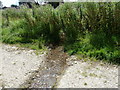
Spring channel crossing footpath 5K
The spring rises in the trees behind.
Image: © Dave Spicer
Taken: 24 Jul 2011
0.11 miles
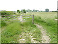
3
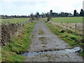
Very small ford on track towards Ockley Manor
The track seems hardly used by vehicles now. It serves Woodside Grange alias Woodside Kennels, but another access route is preferred. The water is running south to north.
Image: © Robin Webster
Taken: 14 Dec 2010
0.13 miles
4
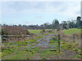
Footpath Hassocks 5K, 2010
Towards Ockley Lane. The area to either side is now becoming a housing estate.
Image: © Robin Webster
Taken: 14 Dec 2010
0.16 miles
5
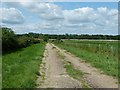
Footpath 5K west to Woodside Grange and kennels
Image: © Dave Spicer
Taken: 24 Jul 2011
0.18 miles
6
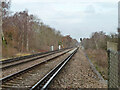
Brighton Main Line towards London
The easing of the gradient down from Clayton Tunnel from 1 in 264 to 1 in 1328 is noticeable. A view from a foot crossing now replaced by a subway.
Image: © Robin Webster
Taken: 14 Dec 2010
0.19 miles
7

Looking northwards on the railway from footpath crossing
See also http://www.geograph.org.uk/photo/2523188 from 2011.
Image: © Shazz
Taken: 22 Jun 2016
0.21 miles
8
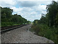
View north on the London to Brighton line
Image: © Dave Spicer
Taken: 24 Jul 2011
0.21 miles
9
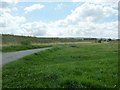
Land for new housing estate
Behind the barrier, land has been allocated for a new housing estate.
Image: © Dave Spicer
Taken: 24 Jul 2011
0.22 miles
10
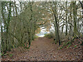
Footpath Hassocks 5K
Heading east from the railway crossing.
Image: © Robin Webster
Taken: 14 Dec 2010
0.23 miles