IMAGES TAKEN NEAR TO
Henfield Road, HENFIELD, BN5 9XJ
Introduction
This page details the photographs taken nearby to Henfield Road, BN5 9XJ by members of the Geograph project.
The Geograph project started in 2005 with the aim of publishing, organising and preserving representative images for every square kilometre of Great Britain, Ireland and the Isle of Man.

There are currently over 7.5m images from over14,400 individuals and you can help contribute to the project by visiting https://www.geograph.org.uk
Image Map
Images are licensed for reuse under creativecommons.org/licenses/by-sa/2.0
Notes
- Clicking on the map will re-center to the selected point.
- The higher the marker number, the further away the image location is from the centre of the postcode.
Image Listing (24 Images Found)
Images are licensed for reuse under creativecommons.org/licenses/by-sa/2.0
Image
Details
Distance
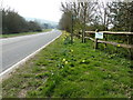
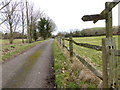
2
Footpath junction with the A2037
See also http://www.geograph.org.uk/photo/3126457.
Image: © Shazz
Taken: 28 Jan 2017
0.05 miles
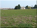
4
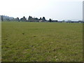
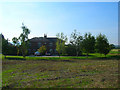
Footpath across pastures at Horton Hall Farm
In the distance are Freeland Cottages part of Horton Hall Farm.
Image: © Dave Spicer
Taken: 27 Mar 2011
0.09 miles
5
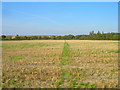
Footpath through the Stubble
Linking Horton Hall's drive with the A2037. A landfill site is on the left hand side whilst the woods surrounding Hillside Scout Camp are to the right.
Image: © Simon Carey
Taken: 27 Sep 2008
0.09 miles
6
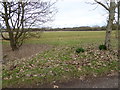
Looking northwards from footpath junction near Horton Hall
Image: © Shazz
Taken: 28 Jan 2017
0.10 miles
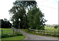
7
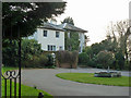
Freeland Cottages
The stone in the centre gives the date of construction as 1830 (or 36) so possibly originally built as agricultural labourers cottages for Horton Hall Farm which is next door though the name may suggest something else. Taken from the footpath that leaves Horton Hall's drive and heads north to the A2037.
Image: © Simon Carey
Taken: 27 Sep 2008
0.11 miles
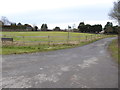
8
Horton Hall
Footpath 2768 has a sign apparently pointing through the iron gates. The more likely route around the outside has a gate with "Private" on it. I did not continue to find out the truth.
Image: © Robin Webster
Taken: 25 Mar 2011
0.14 miles