IMAGES TAKEN NEAR TO
Brighton Road, HENFIELD, BN5 9RR

Introduction

This page details the photographs taken nearby to Brighton Road, BN5 9RR by members of the Geograph project.

The Geograph project started in 2005 with the aim of publishing, organising and preserving representative images for every square kilometre of Great Britain, Ireland and the Isle of Man.

There are currently over 7.5m images from over14,400 individuals and you can help contribute to the project by visiting https://www.geograph.org.uk

Image Map


Images are licensed for reuse under creativecommons.org/licenses/by-sa/2.0
Notes
  • Clicking on the map will re-center to the selected point.
  • The higher the marker number, the further away the image location is from the centre of the postcode.

Image Listing (43 Images Found)

Images are licensed for reuse under creativecommons.org/licenses/by-sa/2.0
  • ...
Image
Details
Distance
1
Limekiln Cottages, Brighton Road
A pair of cottages built in the late 19th century located on the A281.
Image: © Simon Carey Taken: 21 May 2017
0.04 miles
2
Footpath near Limekiln Cottages
Public footpath 2536.
Image: © Peter Holmes Taken: 23 Jul 2016
0.05 miles
3
Furze Field
The name of the field according to Woodmancote's 1839 tithe map that is bounded by Image to the east, Image and Image to the north and Brighton Road, the A281, to the south. Once part of Bilsborough Common, an extension of Henfield Common within the parish of Woodmancote, that was enclosed piecemeal in the 16th and 17th centuries. The house in the distance on the left is The Hollies.
Image: © Simon Carey Taken: 21 May 2017
0.06 miles
4
Footpath to Bylsborough
Public footpath 2536.
Image: © Peter Holmes Taken: 23 Jul 2016
0.07 miles
5
Hundred Steddle Field
The name of the field according to Henfield's 1844 tithe map that has been merged with Image to the south to form a larger unit. To the north east is Image
Image: © Simon Carey Taken: 21 May 2017
0.08 miles
6
The Hundred Steddle Cottage, Brighton Road
The cottage on the right roughly marks the spot where the old hundred court during the 16th and 17th centuries and is roughly the central spot of the parishes of Henfield and Woodmancote which originally formed the Tipnoak Hundred (Albourne was added later). The chimney on the left belongs to Kenton Cottages whilst the field in the foreground is Image
Image: © Simon Carey Taken: 21 May 2017
0.09 miles
7
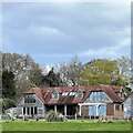
The Hundred Steddle Cottage
This is quite a large house to be called a "cottage", but that is what it says on the map. This is a cross-grid shot. The camera was in the square to the south.
Image: © Ian Hawfinch Taken: 1 Apr 2022
0.09 miles
8
Bridleway to Limekiln Cottages
Public bridleway 3672 adjacent to Brighton Road (A281).
Image: © Peter Holmes Taken: 23 Jul 2016
0.10 miles
9
Church Field
The name of the field according to Woodmancote's 1839 tithe map that lies to the west of Image, north of the A281 and south of Image
Image: © Simon Carey Taken: 25 May 2014
0.11 miles
10
Lane to Eastout
Public footpath 2579.
Image: © Peter Holmes Taken: 23 Jul 2016
0.11 miles
  • ...