IMAGES TAKEN NEAR TO
Brighton Road, HENFIELD, BN5 9RP

Introduction

This page details the photographs taken nearby to Brighton Road, BN5 9RP by members of the Geograph project.

The Geograph project started in 2005 with the aim of publishing, organising and preserving representative images for every square kilometre of Great Britain, Ireland and the Isle of Man.

There are currently over 7.5m images from over14,400 individuals and you can help contribute to the project by visiting https://www.geograph.org.uk

Image Map


Images are licensed for reuse under creativecommons.org/licenses/by-sa/2.0
Notes
  • Clicking on the map will re-center to the selected point.
  • The higher the marker number, the further away the image location is from the centre of the postcode.

Image Listing (71 Images Found)

Images are licensed for reuse under creativecommons.org/licenses/by-sa/2.0
  • ...
Image
Details
Distance
1
Swains Farm
The old and the new juxtaposed. The original farmhouse dates from the 16th century with 18th century additions. In the foreground are Swains Farm Bungalows which were added in the 1970s.
Image: © Simon Carey Taken: 21 May 2017
0.01 miles
2
Scene at Swains Farm
Image: © Ian Hawfinch Taken: 14 Apr 2020
0.01 miles
3
Lorry parked in Swains farmyard
Image: © Ian Hawfinch Taken: 25 Aug 2020
0.01 miles
4
Swains Farm
The main house at this farm, but nearby cottages have a more lived-in air.
Image: © Robin Webster Taken: 10 Mar 2011
0.02 miles
5
Wet leaves on Henfield Common
Image: © Ian Hawfinch Taken: 8 Jun 2022
0.02 miles
6
Swains Farm
A few years ago this place looked almost derelict. Some work has been done on it since then.
Image: © Ian Hawfinch Taken: 14 Feb 2020
0.03 miles
7
Swains Farm
Image: © Ian Hawfinch Taken: 25 Aug 2020
0.04 miles
8
Pallets at Swains Farm
Image: © Ian Hawfinch Taken: 19 Apr 2020
0.04 miles
9
Swains Farm
Image: © Ian Hawfinch Taken: 14 Feb 2020
0.05 miles
10
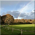
Rainbow over Henfield cricket field
Image: © Ian Hawfinch Taken: 26 Nov 2021
0.05 miles
  • ...