IMAGES TAKEN NEAR TO
Hollands Lane, HENFIELD, BN5 9QZ

Introduction

This page details the photographs taken nearby to Hollands Lane, BN5 9QZ by members of the Geograph project.

The Geograph project started in 2005 with the aim of publishing, organising and preserving representative images for every square kilometre of Great Britain, Ireland and the Isle of Man.

There are currently over 7.5m images from over14,400 individuals and you can help contribute to the project by visiting https://www.geograph.org.uk

Image Map


Images are licensed for reuse under creativecommons.org/licenses/by-sa/2.0
Notes
  • Clicking on the map will re-center to the selected point.
  • The higher the marker number, the further away the image location is from the centre of the postcode.

Image Listing (55 Images Found)

Images are licensed for reuse under creativecommons.org/licenses/by-sa/2.0
  • ...
Image
Details
Distance
1
Sunday Snoozing, Canons
Two pigs having a lunchtime kip in the grounds of Canons viewed through a gap in the foliage on an adjacent public footpath. Not sure of the breed as what you see is all I could see.
Image: © Simon Carey Taken: 14 May 2017
0.01 miles
2
Canons Mead
The name of the field according to Henfield's 1844 tithe map that is bounded by the house called Canons to the south, Image to the west, Image to the north and Image to the east.
Image: © Simon Carey Taken: 14 May 2017
0.04 miles
3
Car in a field - and view towards the South Downs
There is often a car parked in this field - which is a little unusual. The Downs 'summits' range from Newtimber Hill in the east to Truleigh Hill (with the communications masts) in the west.
Image: © Ian Hawfinch Taken: 31 Mar 2020
0.05 miles
4
Common Field
The name of the field according to Henfield's 1844 tithe map that has been merged with Image to the east and Image to the north west to form a larger unit. To the west is Image whilst to the south is Hollands Lane. The buildings in the distance are Oakfield House to the left and leyspring to the right.
Image: © Simon Carey Taken: 14 May 2017
0.07 miles
5
Canons Plot
The name of the field according to Henfield's 1844 tithe map that is bounded by Hollands lane to the south, Image to the east, Image to the north and Image to the west.
Image: © Simon Carey Taken: 14 May 2017
0.07 miles
6
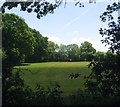
East Hotlands (1)
The name of the field according to Henfield's 1844 tithe map that is located to the south of Hollands Lane. The field has been divided into two fairly recently with this section adjacent to Image to the west. See also Image On the horizon from left to right are: Newtimber Hill, Devils Dyke, Fulking Hill, Perching Hill, Edburton Hill and Truleigh Hill with the transmitter masts.
Image: © Simon Carey Taken: 1 Jun 2017
0.08 miles
7
Obstacle course near Henfield
Image: © Dave Spicer Taken: 22 Mar 2009
0.08 miles
8
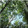
Tree canopy by Hollands Lane
Image: © Ian Hawfinch Taken: 18 Jul 2021
0.08 miles
9
East Hotlands (2)
The name of the field according to Henfield's 1844 tithe map that has been divided into two fairly recently. This is the eastern part which slopes down to the brook lands of the River Adur and thus gives excellent views down the Adur Valley towards the chapel of Lancing College just visible as the square in the centre of the image. See also Image
Image: © Simon Carey Taken: 1 Jun 2017
0.10 miles
10
View south across the Adur flood plain - from Hollands Lane
Image: © Ian Hawfinch Taken: 8 Nov 2020
0.11 miles
  • ...