1
Martyn Close, Henfield
A cul de sac off Church Street that does not appear on a 1946 aerial photograph but does on the 1956 OS map.
Image: © Simon Carey
Taken: 14 May 2017
0.02 miles
2
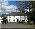
Martyn Lodge, Henfield
The lodge was once the home of Canon Nathanial Woodard who in Victorian times founded several public schools, many of them in Sussex. The lodge is now a residential home.
Image: © nick macneill
Taken: 13 Jan 2012
0.04 miles
3
Henfield - Martyn Lodge
This house bears a blue plaque stating that Nathaniel Woodard lived here. He was the founder of Lancing, Hurstpierpoint, Ardingly - and several other schools.
Image: © Ian Hawfinch
Taken: 5 Mar 2013
0.04 miles
4
Henfield - Martyn Lodge
This house bears a blue plaque stating that Nathaniel Woodard lived here. He was the founder of Lancing, Hurstpierpoint, Ardingly - and several other schools.
Image: © Ian Hawfinch
Taken: 21 Feb 2013
0.04 miles
5
Martyns Lodge, Church Street, Henfield
Built in the 18th century and refurbished during the Georgian period when it appears to have become a single property. The blue plaque commemorates Canon Nathianel Woodard who died here in 1891 having founded a number of well known public schools in the county; namely Ardingly, Hurstpierpoint and Lancing Colleges. The building later became a care home until fairly recently when it was converted into apartments.
Image: © Simon Carey
Taken: 18 Apr 2017
0.04 miles
6
Woodard Mews, Church Street, Henfield
Originally part of the grounds of neighbouring
Image During the 1970s a detached house called Weatheroaks was built on the site which was converted into the current building that contains five dwellings around the turn of the 21st century.
Image: © Simon Carey
Taken: 18 Apr 2017
0.04 miles
7
Rear view of houses on Church Terrace, Henfield
Image: © Ian Hawfinch
Taken: 13 Feb 2020
0.05 miles
8
Rear view of houses on Church Terrace, Henfield
Image: © Ian Hawfinch
Taken: 13 Feb 2020
0.05 miles
9
Parsonage Road, Henfield
A residential road that runs between Church Street and London Road, the A281, that was built in the late 1970s. These houses are located near the junction with the former.
Image: © Simon Carey
Taken: 21 May 2017
0.06 miles
10
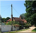
Tannery Cottage, Church Street, Henfield
Located at the junction with Church Terrace and dating back to the early 19th century.
Image: © Simon Carey
Taken: 9 Jul 2017
0.06 miles


