1
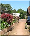
Furners Mead, Henfield
The eastern side of a small estate built in the 1960s.
Image: © Simon Carey
Taken: 9 Jul 2017
0.02 miles
2
Coopers Way Car Park, Henfield
Opened in the late 1970s and one of two main car parks serving Henfield's High Street. Up until 3rd April 2017 it was free to use, since then Horsham District Council has imposed parking charges for every day except Sunday. To add insult the charge for an hour is 75p.
Image: © Simon Carey
Taken: 9 Apr 2017
0.05 miles
3
Scene in Furners Mead
Image: © Ian Hawfinch
Taken: 4 May 2021
0.05 miles
4
The Henfield Hall, Coopers Way, Henfield
Opened as a new village hall in 1974 and since extended in the 1990s to include the local museum and again around 2000 to add another hall. The building can be hired out and is home to a number of local clubs as well as a local weekly market and monthly travelling cinema.
Image: © Simon Carey
Taken: 14 May 2017
0.06 miles
5
The Daisycroft, Henfield
A cul de sac off Furners Mead that was built in the late 1980s. The field it was built in was also called Daisy Croft on Henfield's 1844 tithe map.
Image: © Simon Carey
Taken: 9 Apr 2017
0.07 miles
6
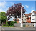
Furners Mead, Henfield
A small housing estate off furners Lane that was built in the mid 1960s. The northern part in view here was built on a former field called Town Mead. The bungalows to the left are known as Holmgarth.
Image: © Simon Carey
Taken: 9 Apr 2017
0.07 miles
7
Coopers Way, Henfield
A cul de sac off High Street that provides access to the village hall, telephone exchange and one of the village's free car parks. To the left is the rear entrance to Budgens which fronts onto the High Street.
Image: © Simon Carey
Taken: 25 Mar 2017
0.07 miles
8
Public Footpath, Henfield
Linking Henfield Common to Furners Lane with this section crossing the southern end of Furners Mead.
Image: © Simon Carey
Taken: 9 Jul 2017
0.07 miles
9
Townmead, Coopers Way, Henfield
The current flats date from around 2010 and were built on the site of a former house of the same name which had been erected between the wars.
Image: © Simon Carey
Taken: 14 May 2017
0.07 miles
10
Evangelical Free Church, High Street
Built in 1834 and realtered and extended to include the new flint frontage in 1904. The chapel is on the corner of High Street and Coopers Way.
Image: © Simon Carey
Taken: 28 Oct 2008
0.08 miles


