IMAGES TAKEN NEAR TO
Stag Close, HENFIELD, BN5 9HG
Introduction
This page details the photographs taken nearby to Stag Close, BN5 9HG by members of the Geograph project.
The Geograph project started in 2005 with the aim of publishing, organising and preserving representative images for every square kilometre of Great Britain, Ireland and the Isle of Man.

There are currently over 7.5m images from over14,400 individuals and you can help contribute to the project by visiting https://www.geograph.org.uk
Image Map
Images are licensed for reuse under creativecommons.org/licenses/by-sa/2.0
Notes
- Clicking on the map will re-center to the selected point.
- The higher the marker number, the further away the image location is from the centre of the postcode.
Image Listing (68 Images Found)
Images are licensed for reuse under creativecommons.org/licenses/by-sa/2.0
Image
Details
Distance
1
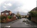
Stag Close
Part of the new housing estate built on the southern edge of Henfield Park, a former medieval deer park.
Image: © Simon Carey
Taken: 29 Nov 2009
0.01 miles
2
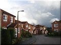
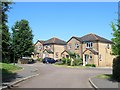
Stag Close, Henfield
A cul de sac off Mallard Way built in the latter part of the 1990s.
Image: © Simon Carey
Taken: 9 Jul 2017
0.01 miles
3
Mallard Way, Henfield
Built in the latter part of the 1990s as part of the Deer Park estate. Viewed from the junction with Image with the entrance to Image visible to the left. The building on the right is a dental surgery.
Image: © Simon Carey
Taken: 9 Jul 2017
0.04 miles
4

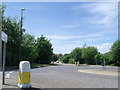
Footpath, Deer Park
An old right of way has been paved and included in a new housing estate, the footpath eventually heading to the A281.
Image: © Simon Carey
Taken: 29 Nov 2009
0.04 miles
5
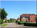
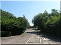
Mallard Way
Part of the new housing estate built on the southern edge of Henfield Park, a former medieval deer park.
Image: © Simon Carey
Taken: 29 Nov 2009
0.04 miles
6
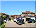
St Peter's View, Henfield
A small cul de sac off Deer Park built in the latter part of the 1990s.
Image: © Simon Carey
Taken: 9 Jul 2017
0.05 miles
7
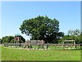
Play Area, Deer Park, Henfield
Small play area located in an open space to the north of Image Beyond is a public footpath and small pond.
Image: © Simon Carey
Taken: 9 Jul 2017
0.07 miles
8
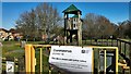
Playground closed due to the coronavirus
Image: © Ian Hawfinch
Taken: 5 Apr 2020
0.07 miles
9
Deer Park, Henfield
The only vehicular access point from London Road, the A281, for the whole Deer Park estate. Viewed towards the main road from the junction with Mallard Way.
Image: © Simon Carey
Taken: 9 Jul 2017
0.08 miles