IMAGES TAKEN NEAR TO
Hewitts, HENFIELD, BN5 9DT

Introduction

This page details the photographs taken nearby to Hewitts, BN5 9DT by members of the Geograph project.

The Geograph project started in 2005 with the aim of publishing, organising and preserving representative images for every square kilometre of Great Britain, Ireland and the Isle of Man.

There are currently over 7.5m images from over14,400 individuals and you can help contribute to the project by visiting https://www.geograph.org.uk

Image Map


Images are licensed for reuse under creativecommons.org/licenses/by-sa/2.0
Notes
  • Clicking on the map will re-center to the selected point.
  • The higher the marker number, the further away the image location is from the centre of the postcode.

Image Listing (335 Images Found)

Images are licensed for reuse under creativecommons.org/licenses/by-sa/2.0
  • ...
Image
Details
Distance
1
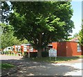
Hewitts, Henfield
A cul de sac off Nep Town Road that was built in the early 1960s. The road turns south at the junction with Hewitts End in the distance, see Image
Image: © Simon Carey Taken: 21 May 2017
0.00 miles
2
Hewitts, Henfield
A cul de sac off Nep Town Road that was built in the early 1960s.
Image: © Simon Carey Taken: 9 Apr 2017
0.02 miles
3
Henfield - Hewitts
Image: © Ian Hawfinch Taken: 6 Jan 2010
0.03 miles
4
Henfield Haven, Hewitts, Henfield
Opened as a council run day centre in the 1970s. The building is still council owned but now let on a long term basis to a community run project dealing with similar issues particularly regarding the elderly.
Image: © Simon Carey Taken: 9 Jul 2017
0.03 miles
5
Hewitts, Henfield, Sussex
Image: © Ian Hawfinch Taken: 7 Feb 2020
0.03 miles
6
Houses on Hewitts and Nep Town Road
Image: © Ian Hawfinch Taken: 6 Feb 2022
0.04 miles
7
Henfield, Sussex - houses on Hewitts
Image: © Ian Hawfinch Taken: 7 Feb 2020
0.05 miles
8
Houses on Nep Town Road
Image: © Ian Hawfinch Taken: 7 Aug 2021
0.05 miles
9
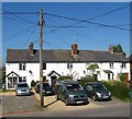
Hedgecocks Cottages, Nep Town Road, Nep Town
Not marked on Henfield's 1844 tithe map but do appear on the 1875-76 OS map which will give some idea of when this terrace was constructed.
Image: © Simon Carey Taken: 9 Apr 2017
0.05 miles
10
Twitten between Henfield High Street and the Common
Image: © Ian Hawfinch Taken: 13 Feb 2020
0.06 miles
  • ...