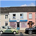
IMAGES TAKEN NEAR TO
High Street, HENFIELD, BN5 9DE

Introduction

This page details the photographs taken nearby to High Street, BN5 9DE by members of the Geograph project.

The Geograph project started in 2005 with the aim of publishing, organising and preserving representative images for every square kilometre of Great Britain, Ireland and the Isle of Man.

There are currently over 7.5m images from over14,400 individuals and you can help contribute to the project by visiting https://www.geograph.org.uk

Image Map


Images are licensed for reuse under creativecommons.org/licenses/by-sa/2.0
Notes
  • Clicking on the map will re-center to the selected point.
  • The higher the marker number, the further away the image location is from the centre of the postcode.

Image Listing (372 Images Found)

Images are licensed for reuse under creativecommons.org/licenses/by-sa/2.0
  • ...
Image
Details
Distance
1
SET Tyres, High Street, Henfield
The garage was built between the wars and was originally part of Betchleys which included a filling station outside Image
Image: © Simon Carey Taken: 23 Jul 2017
0.00 miles
2
Henfield - High Street
Image: © Ian Hawfinch Taken: 6 Jan 2010
0.02 miles
3
Commercial Buildings (2), High Street, Henfield
Commercial Buildings is the name given to a pair of semi-detached buildings built in 1904 to the south of Cagefoot Lane. This is the southern pair now occupied by a single shop, Hartleys, who have traded here since 2008. See also Image
Image: © Simon Carey Taken: 23 Jul 2017
0.02 miles
4
Used Car Dealers, High Street, Henfield
Originally Betchleys Garage which was built between the wars and included Image to the north. Petrol pumps once existed on the forecourt in view.
Image: © Simon Carey Taken: 23 Jul 2017
0.02 miles
5
Buildings on the High Street
Image: © Ian Hawfinch Taken: 16 Nov 2020
0.02 miles
6
Cafe on the High Street
Image: © Ian Hawfinch Taken: 21 Jul 2021
0.02 miles
7
Carwise car dealership, Henfield
Image: © Stacey Harris Taken: 4 Jun 2012
0.02 miles
8
Setyres and Cloud 9 - on the High Street
Image: © Ian Hawfinch Taken: 18 Feb 2020
0.02 miles
9
Greenfield House/Brook House, High Street, Henfield
Greenfield House is the cream fronted house to the left whilst Brook House contains both Taste Deli and the salmon pink coloured dwelling to the right. Both date from the Georgian period.
Image: © Simon Carey Taken: 23 Jul 2017
0.02 miles
10
The Forge, High Street, Henfield
The building dates from the early 17th century and was once the village blacksmith which remained a working forge until 2005/6 when the business moved to Image The building has now been converted into a couple of dwellings.
Image: © Simon Carey Taken: 23 Jul 2017
0.02 miles
  • ...