IMAGES TAKEN NEAR TO
Wheatsheaf Road, HENFIELD, BN5 9AX

Introduction

This page details the photographs taken nearby to Wheatsheaf Road, BN5 9AX by members of the Geograph project.

The Geograph project started in 2005 with the aim of publishing, organising and preserving representative images for every square kilometre of Great Britain, Ireland and the Isle of Man.

There are currently over 7.5m images from over14,400 individuals and you can help contribute to the project by visiting https://www.geograph.org.uk

Image Map


Images are licensed for reuse under creativecommons.org/licenses/by-sa/2.0
Notes
  • Clicking on the map will re-center to the selected point.
  • The higher the marker number, the further away the image location is from the centre of the postcode.

Image Listing (26 Images Found)

Images are licensed for reuse under creativecommons.org/licenses/by-sa/2.0
  • ...
Image
Details
Distance
1
Building on the south side of the B2116
Image: © Ian Hawfinch Taken: 14 Feb 2020
0.00 miles
2
Rear view of Hollinger
Image: © Ian Hawfinch Taken: 14 Feb 2020
0.01 miles
3
Private road and buildings at Hollinger
The road is a public footpath going north to the B2116. See also http://www.geograph.org.uk/photo/1219985 from 2009.
Image: © Shazz Taken: 8 Jan 2017
0.02 miles
4
House called Hollinger
House on the corner of footpath and the B2116
Image: © Dave Spicer Taken: 22 Mar 2009
0.03 miles
5
Vintage Ploughing Match
I assume they mean the ploughs are vintage not the ploughmen
Image: © Dave Spicer Taken: 22 Mar 2009
0.03 miles
6
Park Lane
The name of the field according to Woodmancote's 1841 tithe map that is bounded by Image to the west, Image to the south and the drive to Park Farm to the east which, judging by the name, probably included this narrow field some time in the past. To the north the house in view is Hollinger, originally known as Park Cottage which was substantially extended during the 1980s. The old part of the building is on the right with the gable face on.
Image: © Simon Carey Taken: 18 Apr 2017
0.05 miles
7
Shaw, Wheatsheaf Road (Albourne Road)
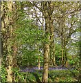
A small shaw on the northern side of the road opposite the entrance to Marthas Barn containing a colourful carpet of bluebells. The shaw contains a number of ponds suggesting it covers an old extraction site.
Image: © Simon Carey Taken: 18 Apr 2017
0.06 miles
8
Wheatsheaf Road (Albourne Road)
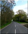
The B2116 that runs from a junction with the A281 on Crouch Hill eastwards to Albourne. The road is known by two names, Wheatsheaf, after the pub that has recently reverted back to that name near the junction with Wineham Lane, and Albourne after its destination - local road signs contain both names. On entering the parish of Woodmancote it becomes Hurstpierpoint Road then Henfield Road. The entrance to Stable Cottage is on the right.
Image: © Simon Carey Taken: 18 Apr 2017
0.08 miles
9
The B2116 near Hollinger
The Albourne Road near to the property known as Hollinger.
Image: © Chris Thomas-Atkin Taken: 8 Jun 2020
0.09 miles
10
The Fifteen Acres
The name of the field according to Woodmancote's 1841 tithe map that is bounded by Wheatsheaf Road, the B2116, to the north, Image to the east, Image to the south and Image to the west.
Image: © Simon Carey Taken: 18 Apr 2017
0.10 miles
  • ...