IMAGES TAKEN NEAR TO
Station Road, STEYNING, BN44 3YL

Introduction

This page details the photographs taken nearby to Station Road, BN44 3YL by members of the Geograph project.

The Geograph project started in 2005 with the aim of publishing, organising and preserving representative images for every square kilometre of Great Britain, Ireland and the Isle of Man.

There are currently over 7.5m images from over14,400 individuals and you can help contribute to the project by visiting https://www.geograph.org.uk

Image Map


Images are licensed for reuse under creativecommons.org/licenses/by-sa/2.0
Notes
  • Clicking on the map will re-center to the selected point.
  • The higher the marker number, the further away the image location is from the centre of the postcode.

Image Listing (361 Images Found)

Images are licensed for reuse under creativecommons.org/licenses/by-sa/2.0
  • ...
Image
Details
Distance
1
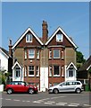
Blencoe/Glenview, Station Road, Steyning
A pair of late Victorian semi-detached town houses located at the junction of Station Road and Cripps Lane. Blencoe on the left is still a single dwelling whilst Glenview to the right has been split into a pair of maisonettes.
Image: © Simon Carey Taken: 29 May 2016
0.01 miles
2
Statue of St Cuthman
Contemplating the site of the church he founded back in the 9th century. The statue dates from 2000 and is by Penny Reeve whilst in the distance is the vicarage on Vicarage Lane.
Image: © Simon Carey Taken: 8 Mar 2009
0.02 miles
3
Gosmark, Station Road, Steyning
The house dates from the late 19th century and is located next to Image
Image: © Simon Carey Taken: 15 May 2016
0.02 miles
4
Daffodils outside the church
Image: © Chris Gunns Taken: 6 Mar 2009
0.03 miles
5
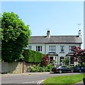
Clyde Terrace, Station Road, Steyning
Built in the 1880s on the old road to the station. The terrace contains four cottages.
Image: © Simon Carey Taken: 8 May 2016
0.03 miles
6
Vicarage, Vicarage Lane, Steyning
Despite the looks the current vicarage was built in the 1960s and replaced Image to the north.
Image: © Simon Carey Taken: 15 May 2016
0.04 miles
7
Southdown Villas, Cripps Lane, Steyning
The original name of a pair of town houses built in the 1860s not long after Steyning station was opened. These days the houses are known as South Down House, partially obscured by foliage on the left, and Silvermead to the right.
Image: © Simon Carey Taken: 29 May 2016
0.04 miles
8
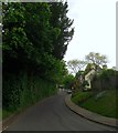
Cripps Lane, Steyning
An old highway that heads north from Jarvis Lane then becomes Vicarage Lane beyond the junction with Station Road at the foot of the slope. Beyond the church the road changes name again to Church Street.
Image: © Simon Carey Taken: 15 May 2016
0.04 miles
9
King Alfred's Close, Steyning
A cul de sac off Vicarage Lane that was built sometime during the 1960s.
Image: © Simon Carey Taken: 8 May 2016
0.04 miles
10
Entering Steyning Museum
Image: © Basher Eyre Taken: 12 Mar 2011
0.04 miles
  • ...