1
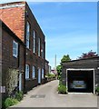
The Old Courthouse, Bank Passage, Steyning
A former town hall that has been converted into dwellings. Built in 1886 to replace an older hall it was accessed via 38 High Street and remained in use until the 1990s when it was replaced by the Steyning Centre. It was converted into dwellings during the late 1990s.
Image: © Simon Carey
Taken: 8 May 2016
0.00 miles
2
Bank Passage, Steyning
Image: © Chris Gunns
Taken: 6 Mar 2009
0.01 miles
3
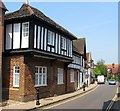
Steyning, Church Street, Looking North.
A wonderful street of old buildings, many still half-timbered with jettied stories.
Image: © Colin Smith
Taken: Unknown
0.02 miles
4
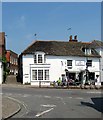
Junction of Church Street and High Street
The Steyning Tea Rooms are offering a take-away service according to the notice in their window. Hopefully places like this can be kept ticking over during this period of suspended animation. Tea rooms are the one thing I will truly miss.
Image: © Ian Hawfinch
Taken: 21 Mar 2020
0.02 miles
5
The Old Town Hall, High Street, Steyning
Not that old compared to its neighbours as it was constructed in 1886 and extended back into bank Passage, see
Image Previously the town's main administration and courts were located at
Image Not sure when it ceased being used but the parish council meet in the steyning Centre these days. The building is now home to an estate agent.
Image: © Simon Carey
Taken: 29 May 2016
0.02 miles
6
4-8, Church Street, Steyning
Numbers 4-6 on the left were originally a single timber framed building dating from the 17th century that were refronted with brick in the 18th century. Number 8 on the right is also known as Flint House and looks like a rebuild from the late 19th century.
Image: © Simon Carey
Taken: 29 May 2016
0.02 miles
7
Church Street - view south towards High Street
Image: © Ian Hawfinch
Taken: 13 Jan 2022
0.02 miles
8
32-34, High Street, Steyning
Number 32 is currently the popular Steyning Tea Rooms whilst 34 is a private dwelling. Both were originally a single house dating from the 16th century. To the left is Bank Passage with
Image visible.
Image: © Simon Carey
Taken: 29 May 2016
0.03 miles
9
10, Church Street, Steyning
Also known as The Forge. The house dates from the 15th century and became a blacksmiths in the 17th which survived until the 19th before converting into a private residence.
Image: © Simon Carey
Taken: 29 May 2016
0.03 miles
10
36, High Street, Steyning
Dating from the early 19th century and on the northern corner of Bank Passage. Currently home to Boddy Matters, a natural therapy clinic.
Image: © Simon Carey
Taken: 29 May 2016
0.03 miles


