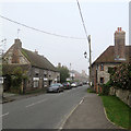
IMAGES TAKEN NEAR TO
High Street, STEYNING, BN44 3WQ

Introduction

This page details the photographs taken nearby to High Street, BN44 3WQ by members of the Geograph project.

The Geograph project started in 2005 with the aim of publishing, organising and preserving representative images for every square kilometre of Great Britain, Ireland and the Isle of Man.

There are currently over 7.5m images from over14,400 individuals and you can help contribute to the project by visiting https://www.geograph.org.uk

Image Map


Images are licensed for reuse under creativecommons.org/licenses/by-sa/2.0
Notes
  • Clicking on the map will re-center to the selected point.
  • The higher the marker number, the further away the image location is from the centre of the postcode.

Image Listing (104 Images Found)

Images are licensed for reuse under creativecommons.org/licenses/by-sa/2.0
  • ...
Image
Details
Distance
1
High Street
The street owes its origins to the 11th century causeway built to cross the Adur estuary to the new Norman seat of power in Bramber. Consequently, the village shifted its settlement away from the church to the north and settled on the causeway next to the bridge and river in order to profit from the new through route. The High Street remained the main road through the village until a southern bypass was opened in 1981.
Image: © Simon Carey Taken: 8 Apr 2008
0.00 miles
2
Cottage at Upper Beeding
Image: © Paul Gillett Taken: 16 Oct 2011
0.02 miles
3
Upper Beeding High Street
Looking in the Bramber direction on a misty late-September morning.
Image: © John Sutton Taken: 27 Sep 2017
0.02 miles
4
Flint cottages, Upper Beeding
Image: © nick macneill Taken: 21 Dec 2012
0.03 miles
5
Holly Cottage, High Street
The datestone on the building gives the date 1740. There is definite evidence that the door on the far side has been bricked up which possibly points to the building once being subdivided.
Image: © Simon Carey Taken: 8 Apr 2008
0.04 miles
6
Two bridges at Bramber
The road bridge and 'The Bridge' inn on the River Adur at Bramber.
Image: © Chris Shaw Taken: 19 Jun 2005
0.05 miles
7
Upper Beeding Baptist Church
Church website: http://www.ubbc.org.uk/
Image: © Paul Gillett Taken: 16 Oct 2011
0.05 miles
8
The Kings Head High Street Upper Beeding
The High Street is part of the Monarch's Way.
Image: © Dave Spicer Taken: 27 Mar 2011
0.05 miles
9
Row of houses on Church Lane
Image: © Ian Hawfinch Taken: 7 Aug 2020
0.06 miles
10
The Kings Head, Upper Beeding
located on the High Street http://www.beerintheevening.com/pubs/s/71/7144/Kings_Head/Upper_Beeding
Image: © Paul Gillett Taken: 16 Oct 2011
0.07 miles
  • ...