IMAGES TAKEN NEAR TO
The Bostal, STEYNING, BN44 3TA
Introduction
This page details the photographs taken nearby to The Bostal, BN44 3TA by members of the Geograph project.
The Geograph project started in 2005 with the aim of publishing, organising and preserving representative images for every square kilometre of Great Britain, Ireland and the Isle of Man.

There are currently over 7.5m images from over14,400 individuals and you can help contribute to the project by visiting https://www.geograph.org.uk
Image Map
Images are licensed for reuse under creativecommons.org/licenses/by-sa/2.0
Notes
- Clicking on the map will re-center to the selected point.
- The higher the marker number, the further away the image location is from the centre of the postcode.
Image Listing (13 Images Found)
Images are licensed for reuse under creativecommons.org/licenses/by-sa/2.0
Image
Details
Distance
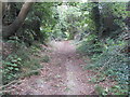
1
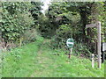
Monarch's Way on The Bostal
Public bridleway 2758.
Image: © Peter Holmes
Taken: 28 Sep 2013
0.02 miles
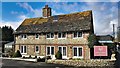
3
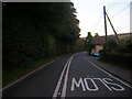
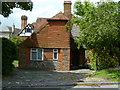
Henfield Road
The A2037 heads through the Castle Town suburb of Upper Beeding. The suburb began to appear around 1808 and the thatched cottage in view is one of the few survivors of the period. Taken from the junction with The Bostal.
Image: © Simon Carey
Taken: 27 Sep 2008
0.05 miles
4
Track to Golding Barn
Restricted Byway 2762.
Image: © Peter Holmes
Taken: 28 Sep 2013
0.09 miles
5
Byway to Windmill Hill
Restricted Byway 2762.
Image: © Peter Holmes
Taken: 28 Sep 2013
0.10 miles
6
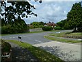
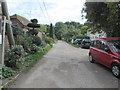
Junction of Maines Farm Road with Manor Road in Upper Beeding
Image: © Shazz
Taken: 24 Jun 2011
0.15 miles
7
View on the east side of the track to Beeding Hill
Image: © Ian Hawfinch
Taken: 11 Mar 2020
0.16 miles
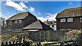
9
Old Manor in Upper Beeding
This is on Manor Road.
Image: © Shazz
Taken: 24 Jun 2011
0.16 miles
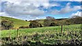
10
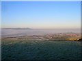
Looking Down Beeding Hill
The line of bushes to the right marks the course of The Bostal the former Beeding-Shoreham coach road. Beyond is Upper Beeding whilst in the distance is Steyning Round Hill. This view would normally also encompass Bramber and Steyning but both are shrouded in fog.
Image: © Simon Carey
Taken: 7 Dec 2008
0.20 miles