1
Coxham Cottages, Coxham Lane, Steyning
Not marked on Steyning's 1841 tithe map but does appear on the 1876 OS map. Until the 1920s these were the only dwellings on Coxham Lane.
Image: © Simon Carey
Taken: 15 May 2016
0.01 miles
2
Coxham Lane
Once connected Horsham Road with Tanyard Lane but now only the former entrance remains though at this point a footpath from Tanyard Lane that eventually heads out of town to the north crosses over the lane.
Image: © Simon Carey
Taken: 8 Mar 2009
0.02 miles
3
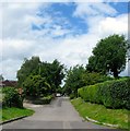
Coxham Lane, Steyning
Originally a farm track that was developed between the wars. Beyond the hedge to the right is
Image
Image: © Simon Carey
Taken: 2 Jul 2016
0.03 miles
4
Shooting Field Football Ground, Steyning
The ground was built in the early 1950s and is home to Steyning Town FC. This is the rear of one of the covered stands on the western side of the pitch. The club formed in 1896 and operated in a number of local leagues until it joined the Sussex County League in the early 1960s. Their heyday was the mid 1980s when it won the Sussex County League title twice and reached the quarter-finals of the FA Vase.
Image: © Simon Carey
Taken: 15 May 2016
0.05 miles
5
The Shooting Field, Steyning Town FC
View of the north goal from next to the entrance to the small stand. Currently residing in Sussex County League Division 2 the club's glory years were the 1980s when they reached the quarter-finals of the FA Vase.
Image: © Simon Carey
Taken: 8 Mar 2009
0.06 miles
6
Steyning Grammar School, Shooting Field, Steyning
Opened in 1953 as Steyning Secondary Modern it amalgamated with the much older Steyning Grammar in 1968. The less photogenic of the two campuses is home to the upper school educating those from year 9 through to 13. A view of the school entrance from the public footpath.
Image: © Simon Carey
Taken: 15 May 2016
0.07 miles
7
Shooting Field, Steyning
A cul de sac off the main access road also called Shooting Field that was built in the late 1940s and early 1950s. This road provides access to Steyning Grammar School's main site, St Andrew's Primary School and Steyning Town's football ground.
Image: © Simon Carey
Taken: 8 May 2016
0.07 miles
8
Shooting Field, Steyning
The cul de sac is off the main access road also called Shooting Field and is part of an estate built in the late 1940s and early 1950s. The estate is named after the large field it was built on.
Image: © Simon Carey
Taken: 8 May 2016
0.09 miles
9
Shooting Field
Council estate built in the 1950s. This part is also the entrance to Steyning Grammar School.
Image: © Simon Carey
Taken: 8 Mar 2009
0.09 miles
10
Stonecroft, Tanyard Lane, Steyning
Houses located on the northern side of Tanyard Lane that are built over the top of Tanyard Stream, though the stream had long been culverted prior to them being built sometime in the late 1930s.
Image: © Simon Carey
Taken: 15 May 2016
0.09 miles


