IMAGES TAKEN NEAR TO
Spithandle Lane, STEYNING, BN44 3DY
Introduction
This page details the photographs taken nearby to Spithandle Lane, BN44 3DY by members of the Geograph project.
The Geograph project started in 2005 with the aim of publishing, organising and preserving representative images for every square kilometre of Great Britain, Ireland and the Isle of Man.

There are currently over 7.5m images from over14,400 individuals and you can help contribute to the project by visiting https://www.geograph.org.uk
Image Map
Images are licensed for reuse under creativecommons.org/licenses/by-sa/2.0
Notes
- Clicking on the map will re-center to the selected point.
- The higher the marker number, the further away the image location is from the centre of the postcode.
Image Listing (45 Images Found)
Images are licensed for reuse under creativecommons.org/licenses/by-sa/2.0
Image
Details
Distance
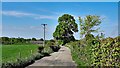
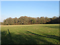
1
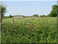
View across hedgerow and field to Guesses Farm
Image: © Dave Spicer
Taken: 24 May 2009
0.01 miles
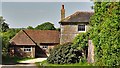
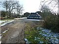
2
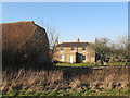
Guesses Farm
A view of the southern wing of the farmhouse which dates from the early 19th century and was added to a much older 17th century northern wing. Still a working farm today.
Image: © Simon Carey
Taken: 20 Feb 2013
0.02 miles
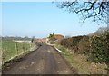
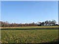
5
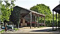
Barn at Guesses Farm
I would say that the front end of the barn (on the left) is just about in TQ1515. The rest of the barn is probably in TQ1514.
Image: © Ian Hawfinch
Taken: 26 Apr 2020
0.04 miles
6
Limekiln Field
The name of the field according to Wiston's 1841 tithe map that lies to the south west of Image
Image: © Simon Carey
Taken: 20 Feb 2013
0.05 miles
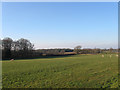
9
Crabtree Field
The name of the field according to Wiston's 1841 tithe map viewed from the footpath that links Jack O'Lantern Wood to Spithandle Lane. Spithandle Copse is at the end of the field.
Image: © Simon Carey
Taken: 20 Feb 2013
0.09 miles
10
Common Fields
The name of the field according to Wiston's 1841 tithe map that more than suggests the location of an old common either on the site of the field or nearby.
Image: © Simon Carey
Taken: 20 Feb 2013
0.11 miles